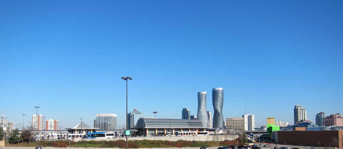
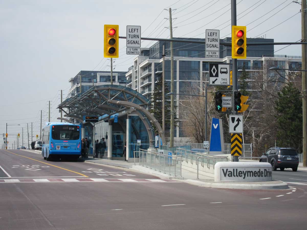
I haven’t paid much attention to this website as I should have for some time because I have had other commitments. But an article by Marcus Gee, “Suburbs are booming with transit” in the Globe and Mail, Nov 28, 2014, has prompted me to reflect on what is happening with transit in GTHA municipalities other than the City of Toronto. His article described some of the new buses, corridors and stations in Markham and Brampton and particularly the recently opened first section of the Transitway in Mississauga. This bus only lane along Highway 403 for MiWay (Mississauga Transit) and GO buses should be faster than car travel, and when the complete Transitway is complete it will reduce travel time to Pearson from downtown Mississauga from 50 minutes to 20 minutes. It is only one of a number of major investments to improve public transit facilities in the outer suburbs.
I have observed bus terminals, rapidways, emergent mobility hubs and so on for several years, but to put those into a broader context here I have turned to comparative data about the role of transit in the outer suburbs that are available in the National Household Survey 2011 data on commuting (Focus of Geography Series, Census subdivisions with more than 5000 population, Labour Tab, Mode of Transportation). These show numbers of people driving, taking transit, walking and cycling to work by individual municipalities. Then I consulted Walkscore.com for its assessment of walkability.
[The day after posting this I read the comments by David Hulchanski, Robert Murdie, Alan Walks and Larry Bourne at http://neighbourhoodchange.ca/2014/11/07/nhs/ about the worthlessness of NHS data because the global non-response rate is greater than 25% nationally and much higher than that is some neighbourhoods. I was aware of the Harper Governments meddling with the census, but this was the first time I have used NHS material and until now was not aware of the depths of its weakness. I have gone back to 2006 census data to check how they compare, and incorporated 2006 data into calculations of transit use]
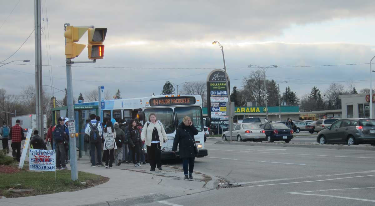
York Region bus stop at Bayview and Major Mackenzie
Some Background ( Note: the following ridership numbers are from various sources and may not be consistent)
• There are regional transit systems in:
York Region Viva bus at Rapidway stop on Hwy 7, with densification in the background
York Region, annual ridership 24 million, dedicated right of way (Rapidway) for express Viva buses partially completed along Hwy 7, links to York University, Finch Subway station, Fairview Subway station (and future Vaughan Station). Major mobility hub planned for area existing terminal at Yonge and Hwy 7 (Lansing/Richmond Hill). Densification along much of route, especially at Downtown Markham. Plans for corridors and hubs network.
Durham Region, annual ridership 11 million, plans for bus rapid transit. There is a major terminal at Pickering Mall, and links to GO train stations. An express route with traffic signal priority for ‘Pulse’ rapid transit buses runs along Hwy 2 from Oshawa to the University of Toronto Scarborough in mixed traffic, but it is intended to create an HOV lane in the near future.
• There are municipal transit systems in:
Brampton, annual ridership 12 million, Züm express buses currently operate in mixed traffic but with plans for dedicated lanes. They run to Mississauga City Centre and York University as well
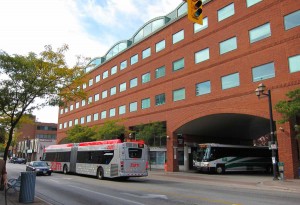
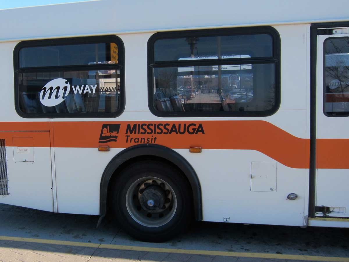 Mississauga (MiWay), annual ridership 35 million, dedicated right of way (Transitway) shared with GO, connects with Kipling Subway station. There are unfunded plans for an LRT running from Port Credit, through Mississauga City Centre to Brampton downtown.
Oakville, annual ridership 3 million.
Burlington, annual ridership 2 million.
Hamilton Street Railway, annual ridership 22 million. Inteconnects with GO at the Art Deco Hamilton GO station and at the new station at James Street being built for the PanAm games which will be the focus of a mobility hub. Has distant plans for an LRT linking downtown Hamilton to McMaster
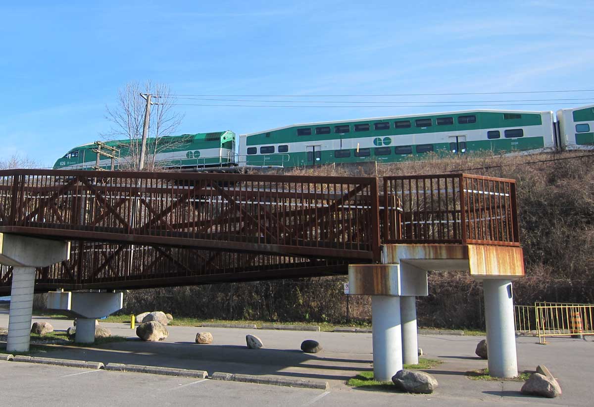
GO train crossing the Rouge River. The ramp is part of the bridge for bikes and pedestrians.
• The GO system of buses and railways, now under the aegis of Metrolinx, operates throughout the region. It has an annual ridership of about 75 million, expected to grow to 120 million by 2020. The commuter railway has the fifth highest ridership in North America after the three rail lines in New York City and Chicago, and 90% of its riders pass through Union Station. The trains carry about ¾ of all riders and buses carry ¼ (some on cross regional routes that by-pass the City of Toronto). The GO2020 Plan was developed in 2008 after the Big Move and incorporates many of its ideas and initiatives about hubs and corridors. The Green and White GO buses and trains are probably the strongest indicators of the range of the Toronto metro region.
• All transit initiatives in the GTHA are now governed by the Big Move plans of Metrolinx that concur with requirements for densification laid out in the Growth Plan for the Greater Golden Horseshoe.
• Total annual ridership of all these systems (including GO) is about 185 million compared with about 514 million on the TTC, though the population of the outer suburbs is greater than that of Toronto.
• The National Household Survey gives an average commuting time for the City of Toronto of 33.5 mins – that’s higher than Vaughan (30.5), Oshawa (30.6), Newmarket (30.9), Mississauga (30.9), Hamilton (26.7), and Burlington (27.8). Ajax (38.3) and Pickering (35.8) have the longest commute times in the region.
Comparative Data
Marcus Gee states that 84% of trips in Mississauga are by automobile. This does not quite correspond with the National Household Survey 2011 data on commuting which show 16% of commuting trips there are by transit, but an additional 3% are by walking and cycling. I think the combined percentages are more useful than the transit only one, so I show these in the table below. (In Victoria, for example, only 14% of commutes are by transit, but so many people walk or cycle to work that the combined value of all three is 47.5%).
Walkscore.com has established the importance of walkability across North America, and its walkability scores are widely used by real estate agents. Walkscores are available for most of the GTHA municipalities, and I have also included these. The methodology can be questioned (in particular I am not sure of how they determine the areas they use) but it is consistent. A score of 70 or more means a city is very walkable, 50 to 70 is somewhat walkable and some errands can be done on foot, less than 50 means most errands require a car. Note that Mississauga’s walkscore is the fourth highest in Canada for large municipalities (after Vancouver, Toronto and Montreal), and ranks 30th in North America.
Here are the values for the outer suburban municipalities in the GTHA – commute time, per cent trips by transit from the 2006 census and 2011 NHS, % trips combining transit, walking and biking from the 2006 Census and 21011 NHS, and walkscores from the 2014 Walkscore website. In mostly rural municipalities, such as Caledon, less than 10% of commutes are by transit/walking/cycling.
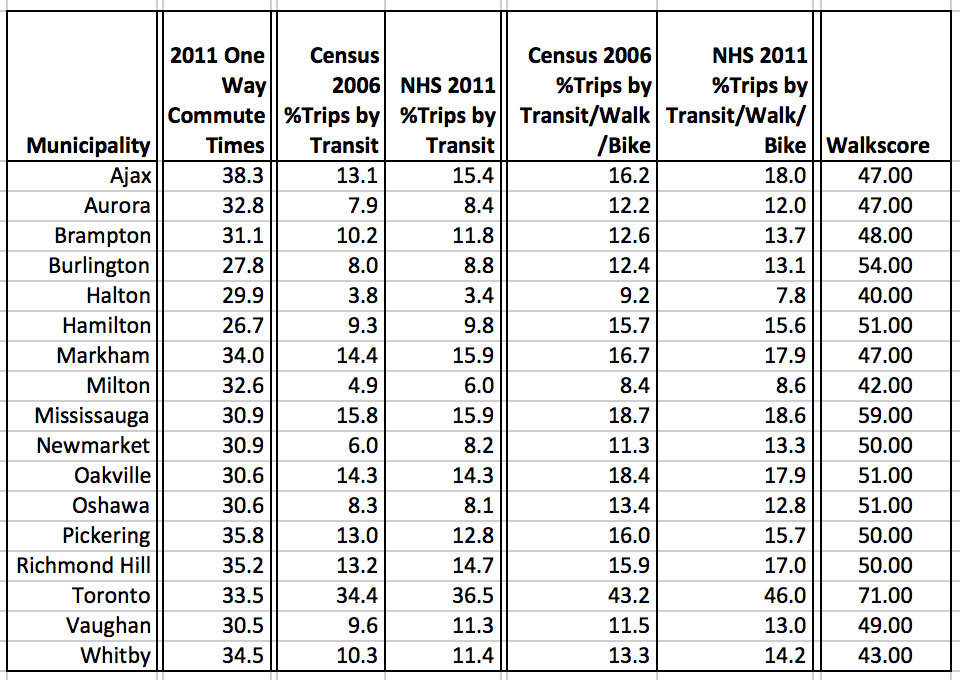
In so far as the 2011 figures of dubious quality from the National Household Survey can be compared with the figures from the 2006 census, they mostly show small increases of about 2% in transit use and in transit/walking/biking to work. In other words growth in transit ridership/walking/cycling to work has slightly more than kept pace with population growth.
Comments
The outer suburbs with the most developed bus rapid transit systems attract about 1/3rd of the proportion of commuters as the TTC. In the GTHA only Toronto has a walkscore that rates it as very walkable, and eight of the outer suburbs are considered to be somewhat walkable. My guess is that Brampton, Markham and Vaughan will soon pass the 50 mark.
To put these numbers in perspective for all the major urban centres in Canada: Only Victoria (78), Vancouver (78), Toronto (71), Montreal (70) and Halifax (70) rate as very walkable. Burlington (54) ranks 11th in Canada. London (49), Kingston (49), Quebec City(49), Calgary (48), Peterborough(47) and Guelph (47) are about the same as most of the outer suburbs that are rated as car dependent.
What does all this mean on the ground?
-
Brampton’s GO rail station is on an elevated track behind this office building, and has a bus loop for Züm and GO buses.
First, these data mask a lot of local variations. There are unquestionably pockets of high walkability in the outer suburbs – the centre of Whitby, the town of Markham, Unionville, old Richmond Hill, downtown Brampton with its pedestrianized area around the Rose Theatre and the integrated GO train station and bus station just off Main Street, Erin Mills, Port Credit, Oakville and Burlington.
-

Mississauga Centre Terminal is awkwardly situated above Square One mall, which is to the right on a lower level, and across the street from the GO bus station, which is to the left of this photo.

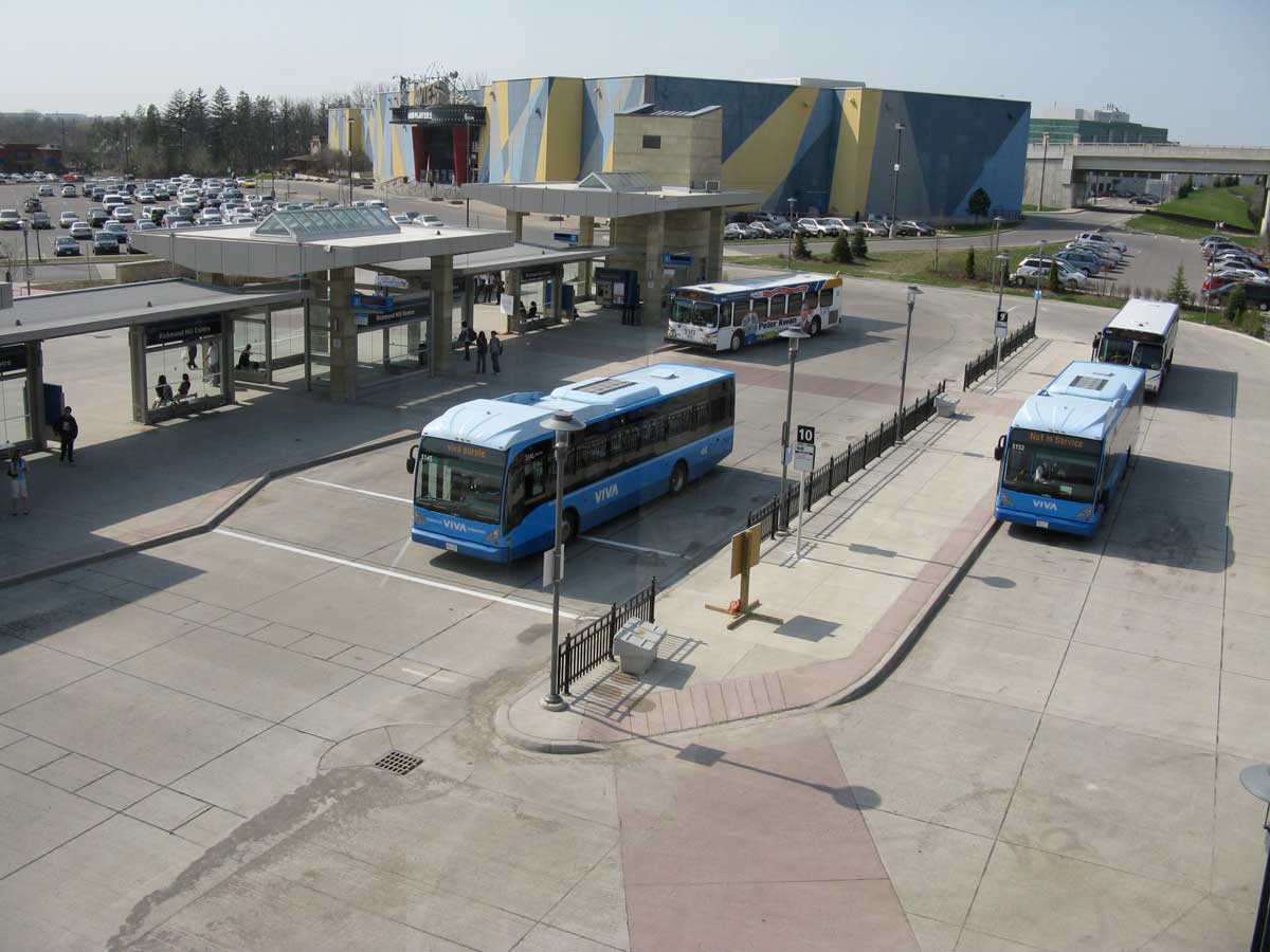
York Region terminal at Lansing/Richmond Hill, next to a Cineplex and a mall, but at arm’s length
Second, there are indications of nascent mobility hubs, such as Downtown Markham, the new James Street station in Hamilton, but the standard practice of the regional and municipal transit authorities has been to built terminals adjacent to but at arms length from shopping malls – close but not integrated. This is the case at Pickering Town Centre and at Square One in Mississauga. Malls may be destinations but these terminals are currently sterile, windy, places. To work well the bus terminals need to be part the building. And for mobility centres to work well they need to integrate as many uses as possible – residential, retail, colleges, workplaces, small urban spaces, not just to have some high density housing around them.
-
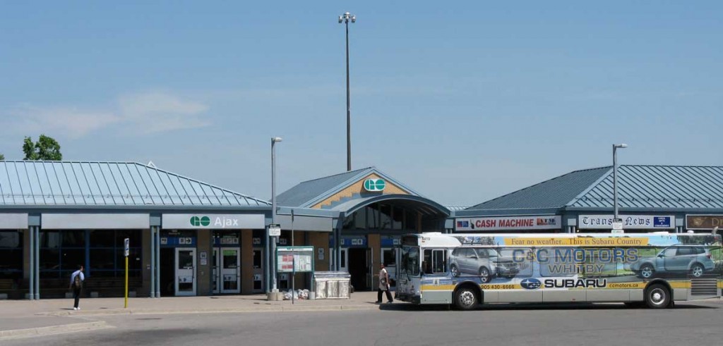
GO train station at Ajax, with Durham Region bus terminal and convenience stores. The bus is wrapped in an ad for for a local car dealership. GO train stations provide free parking, and several, including Ajax, Pickering, Whitby, Oakville and Burlington have multi-storey parking structures.
Third, I am impressed by some of the GO railway stations on the Lakeshore line that have combined large parking structures with bus loops, child care centres, cafes and convenience stores.
- Fourth, as Marcus Gee points out in his article, the outer municipalities are actively engaged in major improvements to their transit, specifically the implementation of bus rapid transit. Even Halton (which has a minimal system at the moment) is contemplating a bus rapid transit lane along Hwy 5. York Region’s rapidway Viva system and Miway’s transitway are remarkable experiments in changing travel habits. And they have been implemented at the very time that Toronto’s politicians have been caught up in ideological disputes about transit city, subway extensions, and smart track. There is a long way to go, but I see them as part of the early stages of a remaking of suburban urban forms and travel patterns.

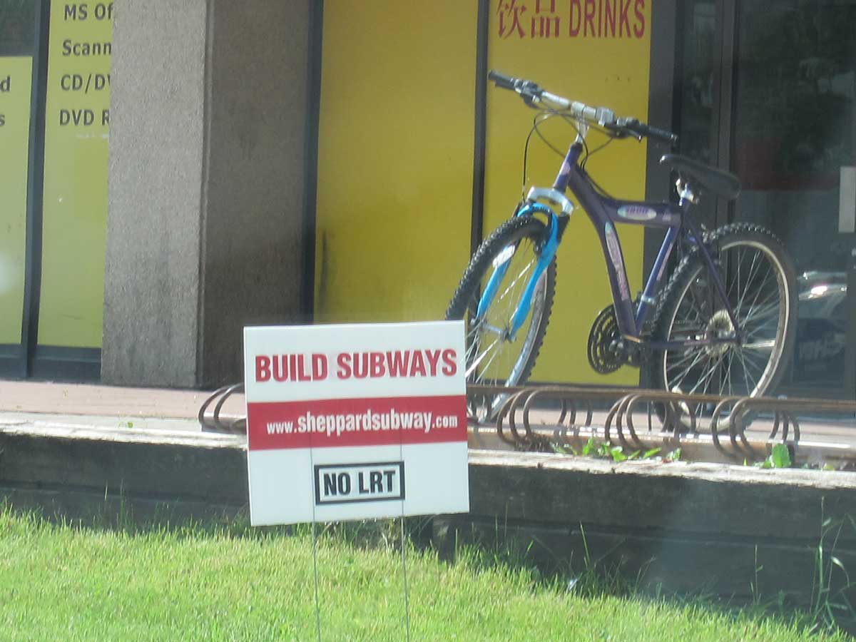
A moment in the City of Toronto’s ideological conflicts over transit. This sign was at Sheppard and Kennedy in Scarborough in early 2014.