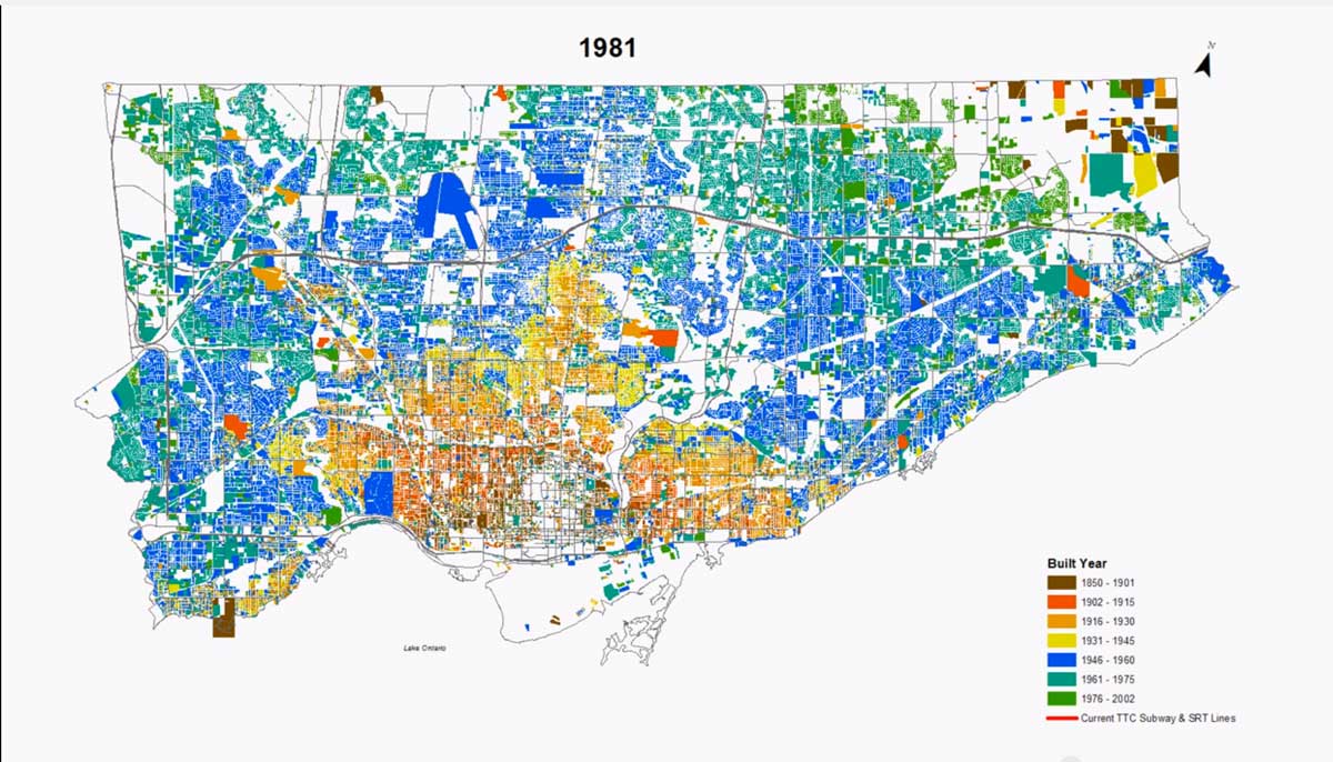
I have just come upon an intriguing short timeline video of the growth of the built up area of the City of Toronto from 1901-2002. This was presented at a planning roundtable on The Shape of the Suburbs in Fall 2013, and it was posted here on YouTube, but has had few viewings – a little over a hundred. I think it warrants more attention than that, and also a somewhat slower means of digesting what the video shows, so I have clipped the maps for each decade (1901, 1911 etc – the years of the Canadian census). Here they are, with a few comments – they all enlarge if you click on them.
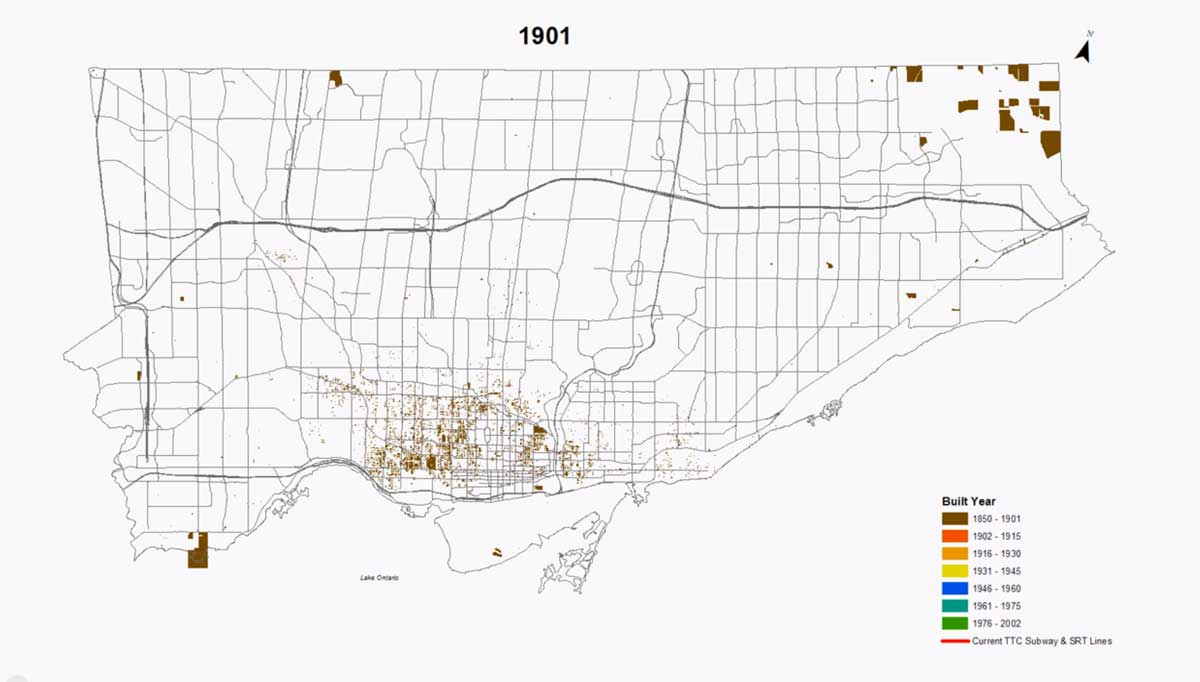
Note that this shows some large areas “built” in the north-east corner – I assume these were farms – some of which are still there in the one rural corner of the City that is now the Rouge Park. The base map is a current one – Highway 401 and the Don Valley Parkway are shown for reference, and many of the arterial roads shown here were only opened all the way after 1950.
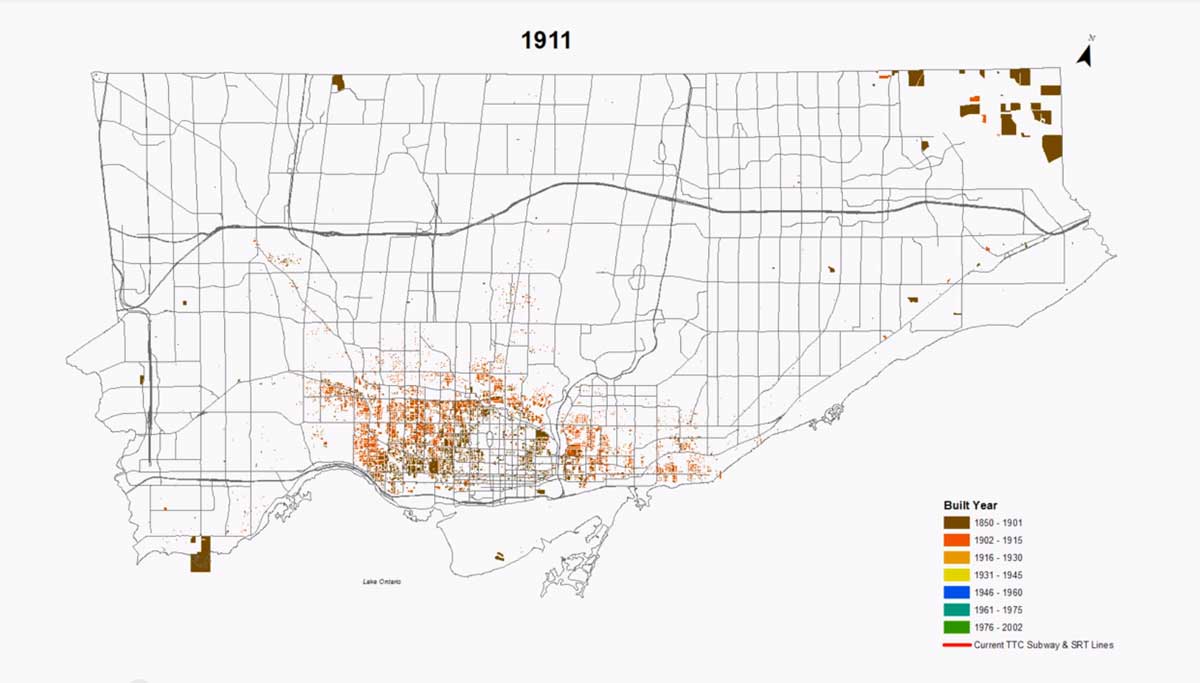
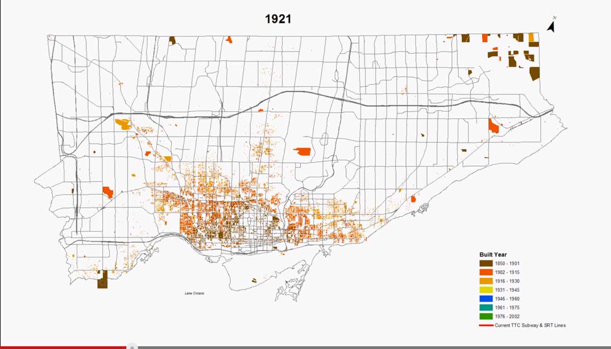
The 1911 and 1921 maps show the growth of the streetcar city as the electric streetcars pushed east and west of the downtown core, and north along Yonge Street. The large orange patches are, I believe, large estates, now mostly parkland in Sunnybrook and Highland Creek.
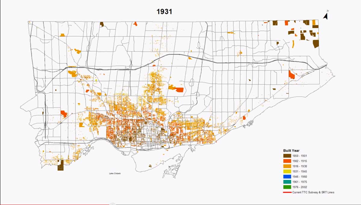
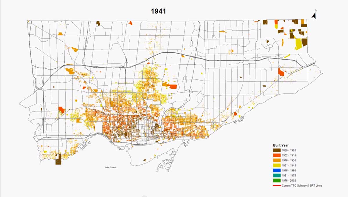
The built-up area in 1931 corresponded closely to the boundaries of the old, pre-1998 City of Toronto. There was little change in the Depression years between 1931and 1941.
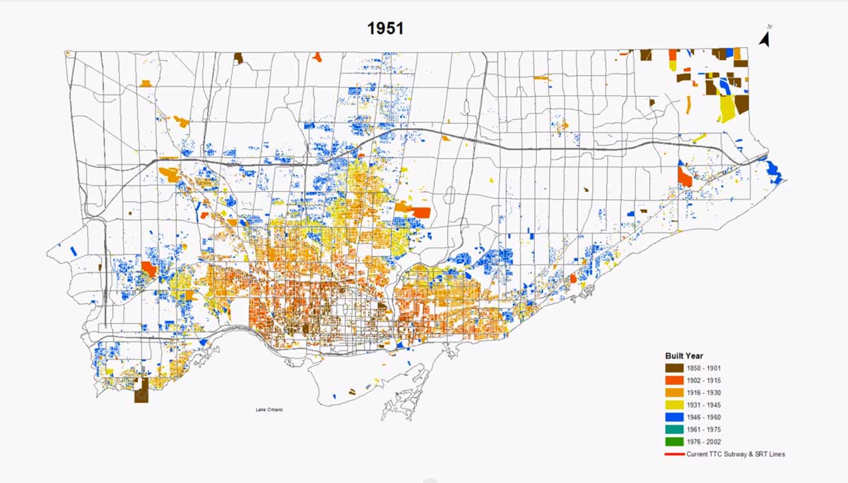
The blue patches are the harbingers of the much more extensive automobile-oriented suburban growth that was to come. Many of them in 1951 were small clusters of little houses – a little over 1000 square feet, bungalows or story and a half. This was before either Metro or effective planning were in place, and they were scattered throughout the townships that surrounded the old City of Toronto.
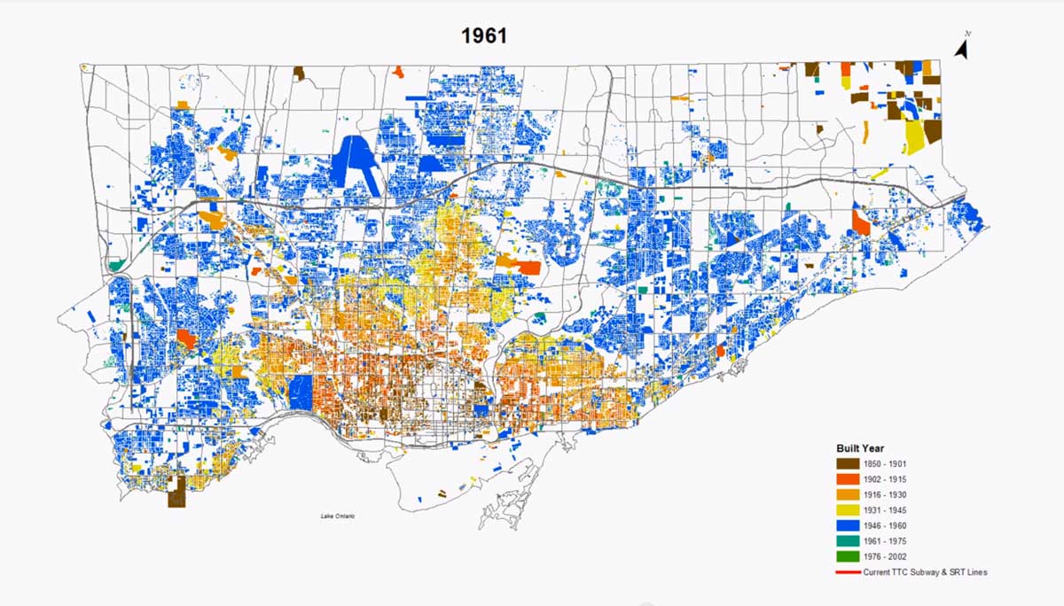
This captures the beginning of the great outward surge of the post-war decades. Don Mills is a partial circle just to the right of centre. One of the probable consequences of Metro planning is that the new growth was mostly at the edge of the previously built area – no more scattered and isolated little development, but substantial subdivisions. The large solid blue patches just north of Hwy 401 are Downsview Airfield and parkland (and, I think, the cemetery just west of downtown North York). High Park is also shown as a large blue patch (this is a minor problem with this sort of computer generated mapping – one new building in a park means the whole patch is covered because that is how the data are coded).
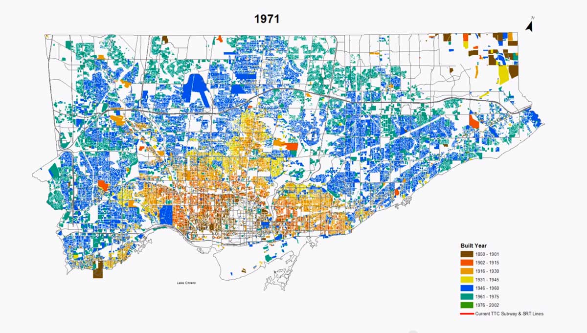
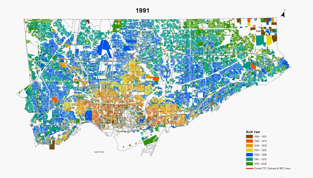
By 1971 what was then Metro Toronto was mostly full and urban development was beginning to spill over its boundaries to the west and the north. The remaining areas of Metro, mostly in Scarborough in the north-east, would be built up over the next 30 years. I think 1971 was when Toronto began its transformation to a post-suburban city because it was already becoming clear that unless Metro’s boundaries were expanded conventional suburban growth had a relatively short future.
The white areas on the edge of Metro have almost disappeared, and if you look carefully at, for instance the Don Valley, you can see evidence of infilling.
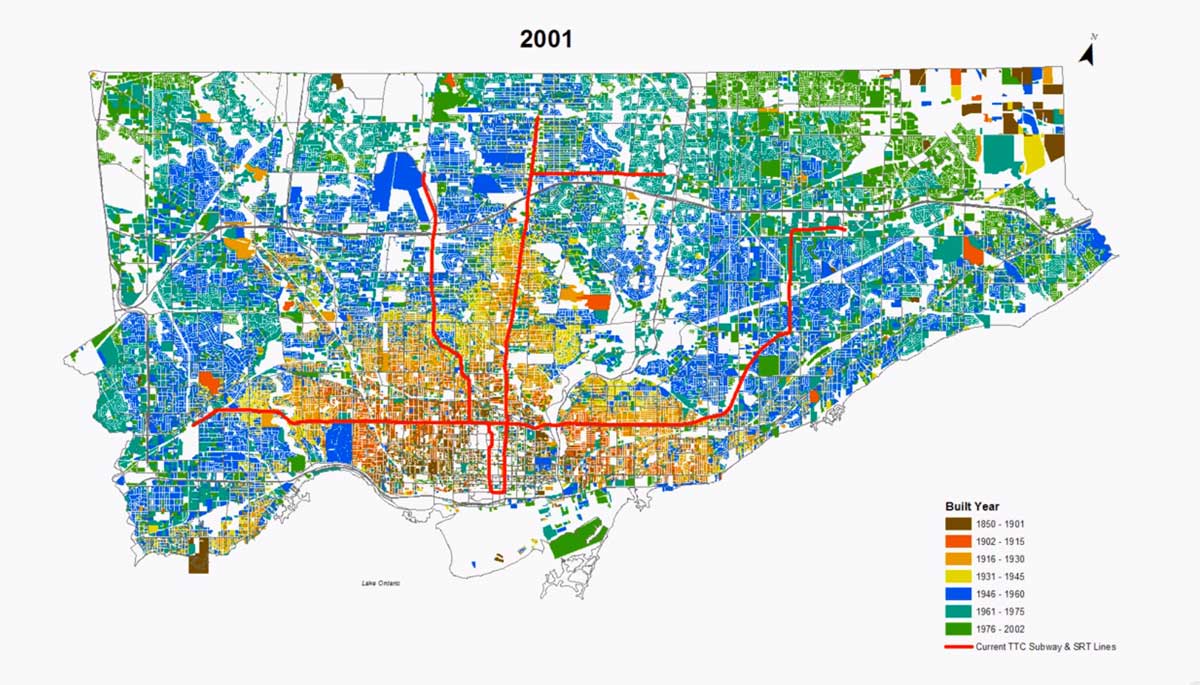
The subway lines and Scarborough Rapid Transit have been added to the 2001 map, though they were actually built at various dates between 1950 and 2010. Otherwise there was not a lot of obvious change from 1991. This map conveys very well the overall urban structure of the built-up area of Toronto – the old streetcar city in browns and yellows, the bands of post-war suburban growth, and also small areas of renewal and infill, in blues and greens. Unshaded areas are not patches available for development. They are a combination of ravines and parks (the Don Valley most obviously), the hydro corridors that cut diagonally through built-up areas like Haussmann avenues, the railroad yard in Agincourt, some industrial areas in the north and west parts of the city, and university campuses (both the University of Toronto and York University are unshaded).