 This page is part of the companion website to my book Toronto: Transformations in a City and its Region, published by UPenn Press.
Galactic City
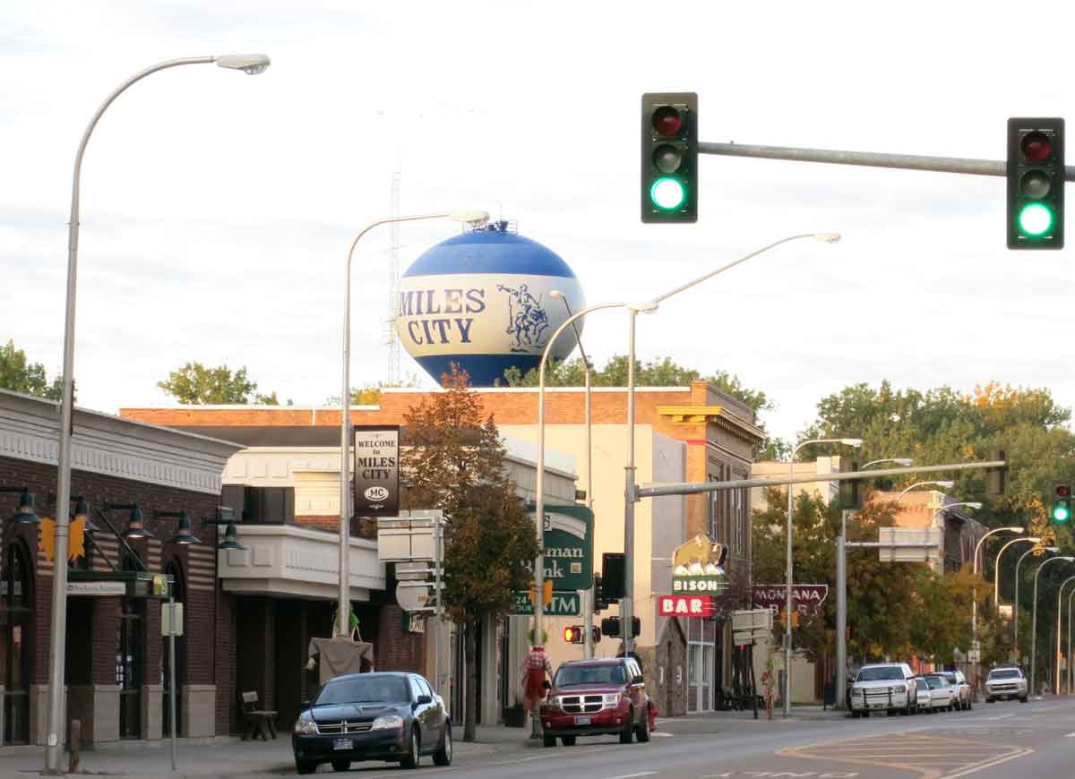
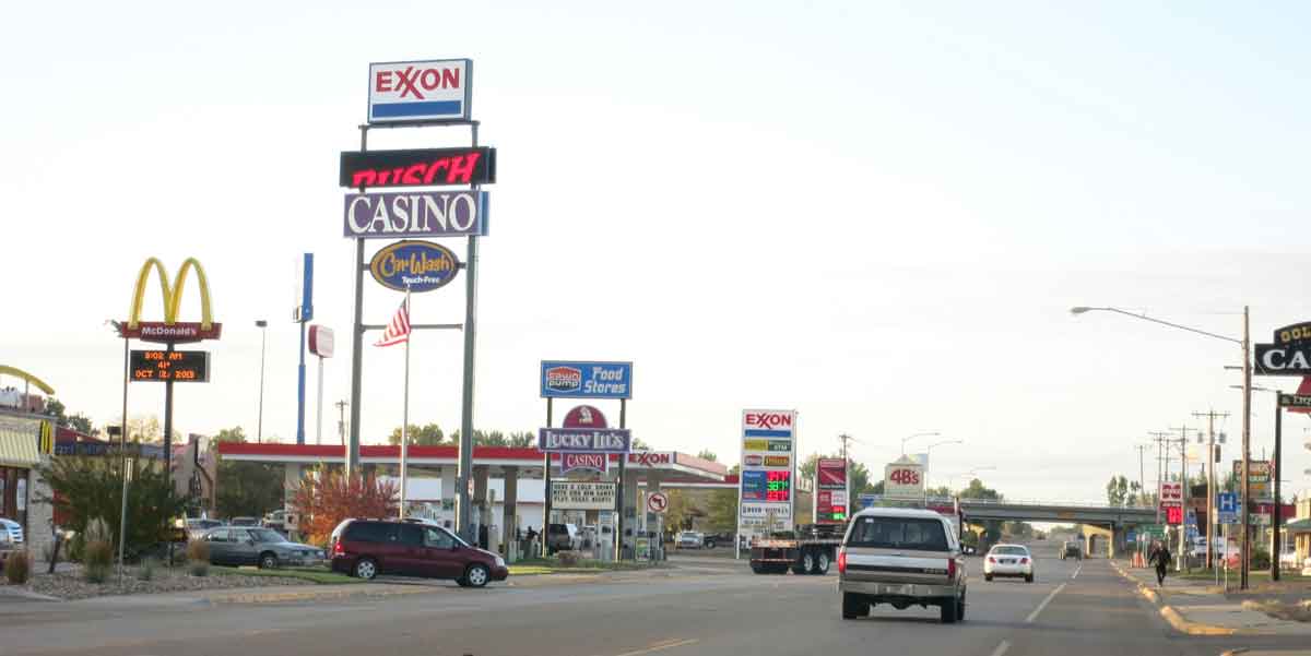
As an industrial city Toronto was, like many industrial cities, monocentric, with one dominant downtown serviced by railways and streetcars, surrounded by suburbs. I begin Chapter 7 of my book with a discussion of Peirce Lewis’ suggestion that this simple urban structure began to break down with the introduction of motor vehicles, and has now been replaced by a galactic metropolis in which everything is available more or less everywhere – exotic goods, he suggests, can be delivered just as easily to Miles City, Montana as Manhattan. Since I have recently been in Miles City, here are a couple of photos. On the left the old main street with the Bison Bar, and on the right the commercial strip leading to Interstate 94 with familiar placeless signs of the galactic city.
Lewis’ point is that the modern urban universe no longer consists of distinctive monocentric cities. Both in terms of city functions and our experiences, the qualities of urbanity are now unbounded. Cars have been an important factor in this, but their effects have been amplified by electronic communications. At the regional level, such as the Greater Toronto and Hamilton Area, this is manifest in a polycentric urban form tied together by numerous superimposed networks of infrastructure and communications.
Deconcentrated Concentrations
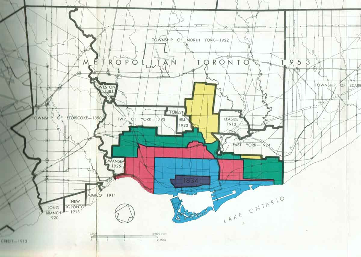
Here are some illustrations that capture this shift from monocentricity to what I discuss as “deconcentrated concentrations” (Peter Hall’s term) and superimposed networks. Below are two maps from the1959 Draft Official Plan for Metro Toronto. The one on the left shows journeys by transit into downtown Toronto, which then exerted the greatest gravitational forces in the region. The map on the right shows annexations by the old City of Toronto from 1834 to 1954, clearly indicating the idea of growth out from an initial urban seed. The notion that Toronto has grown outwards from this seed is a commonplace, and was not inaccurate up until the 1970s; it carries with it the ideological assumption that the old city core does and should hold sway over the rest of the region.

 More recent maps of the Toronto region offer a very different perspective. For instance, this map of noise zones from the Greater Toronto Airports Authority for 2007 shows the landing (in purple) and take-off (in orange) flight zones for Pearson Airport, superimposed on networks of arterial roads and expressways, some leading into the airport but most bypassing it. Downtown Toronto is in the bottom right.
And the 1990 map below from IBI, planning consultants retained by the province to report about options for regional planning, shows possible future nodal growth in the Toronto region. It identified 41 potential centres for growth, an idea that is now being implemented in a modified way in regional plans – the old downtown core is just one among many centres (Pearson airport is another). What these convey to me is that a sea change has occurred in thinking and practice about cities, their regions, and their function. If you are inclined to look at the metropolitan region from the centre looking out, this change may not be immediately apparent.

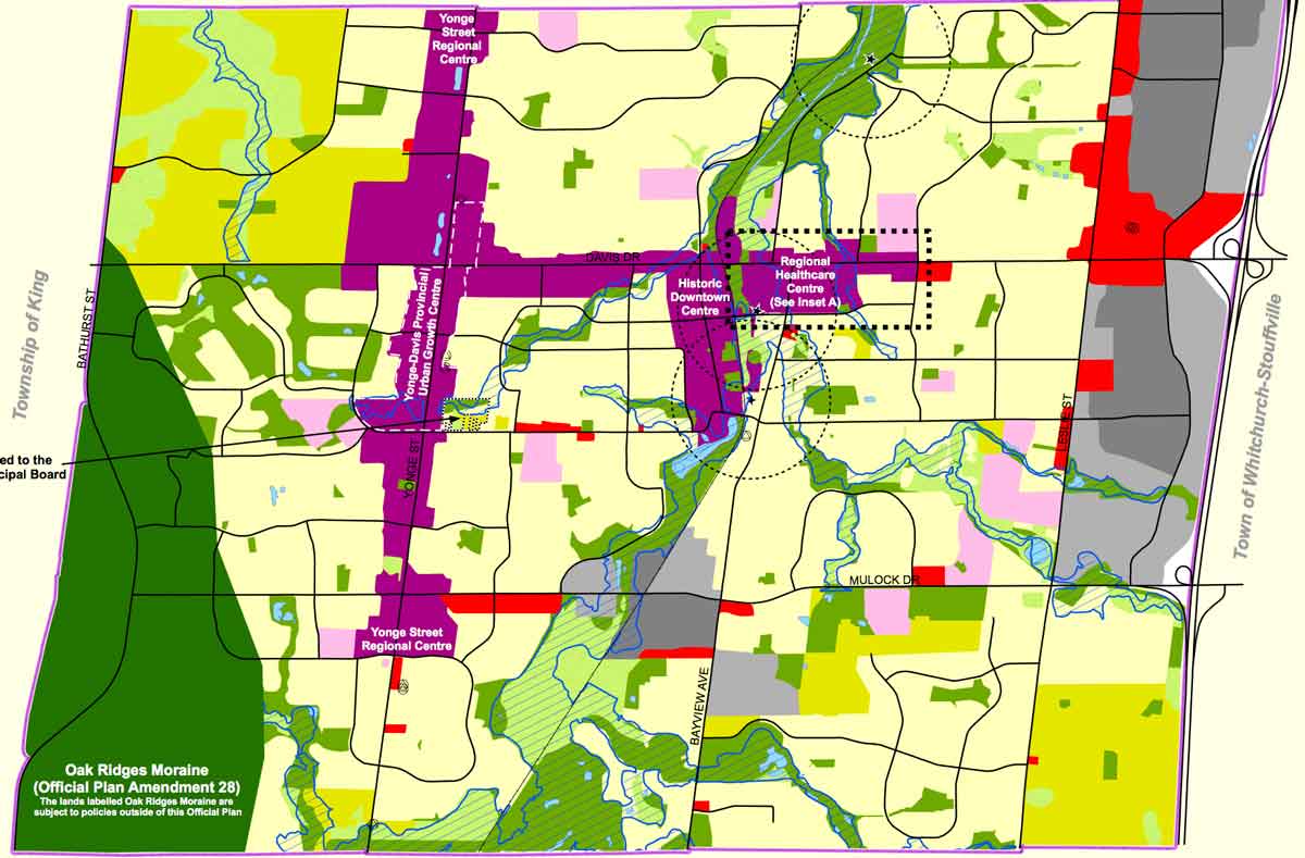 The nodal map does, however, offer a rather simplistic picture of polycentricity because it implies that all centres are somehow discrete. In fact, there are many different types of centres in various different types of networks, juxtaposed and/or superimposed. Here’s a map from the Official Plan for the Town of Newmarket (which I refer to in Chapter 7, and is the northernmost red circle on the map of proposed nodes, above). It shows two Yonge Street regional centres (as designated in the official plan for York Region), the Yonge provincial urban growth centre (as designated in the Growth Plan for the Greater Golden Horseshoe), the historic downtown centre (a.k.a. the old main street) and the regional health care centre (a.k.a. the hospital, and part of a regional network of hospitals). In the galactic city and a world of electronic communications everywhere is a centre of some sort.
Networks of Infrastructure
Linking the many centres of different sorts are various networks of infrastructure. These tend to go uncommented even if they are very visible. Here are some examples.

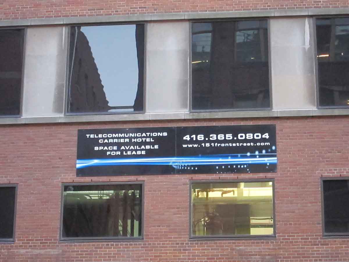
This telecommunications carrier hotel on Front Street in downtown Toronto, originally built for telegraph lines, is now where intercity fibre optic cable (much of which, like the telegraph, follows railway lines) connects with local internet providers. It is an essential interchange in the electronic networks of Toronto.
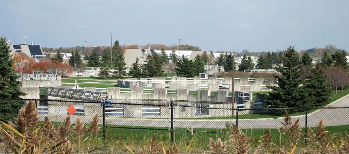
This map shows the “big pipe” sewer installed in the 1970s to service areas north of Metro Toronto. Red squares are pumping stations and the red triangle is the huge sewage treatment plant at the mouth of Duffin’s Creek in Pickering, shown in the photo on the right, adjacent to the nuclear power plant. Like most of the treatment plants in the region it is mostly hidden behind berms and other forms of landscaping and smells of phosphate from detergents.

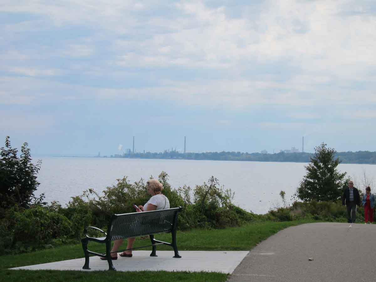
The shoreline of Lake Ontario serves as a sort of infrastructure front line for the region. This map shows the largest and most obvious facilities between Clarington in the east and Hamilton in the west. There are many smaller water intake facilities, and several sites of demolished or mothballed thermal generating stations, in addition to commercial ports at Oshawa, Toronto and Hamilton. A waterfront trail for walking and biking, and part of a part of network of such trails, runs along much of the lakeshore, skirts around these various infrastructure facilities, and is one of the great recreational amenities of the region.
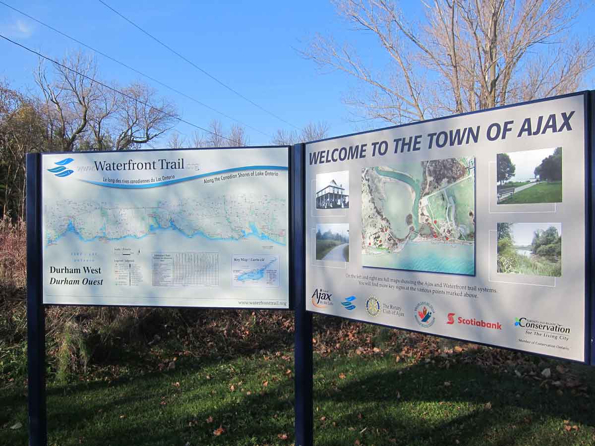
The Oakville oil refinery seen from the waterfront trail at Port Credit, and a sign for the trail as it enters Ajax.
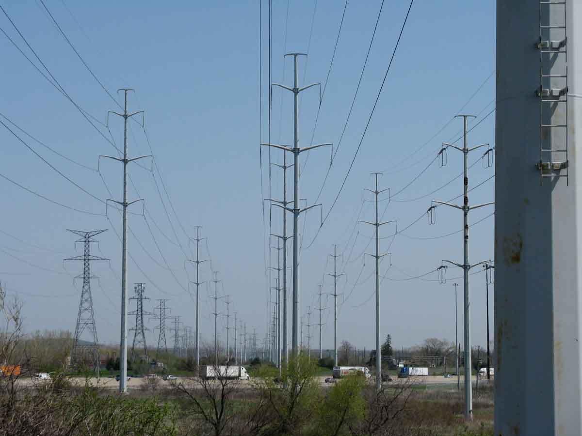

The most visible networks of infrastructure are those associated with electricity. In addition to wires and poles along most streets, there are major Hydro corridors, such as this one at Morningside and Hwy401, feeding Toronto’s appetite for energy. Many end in step-down transformers like the one at Finch and Yonge. My informal impression is that landscapes associated with electricity are more prominent in Toronto than in most other cities.
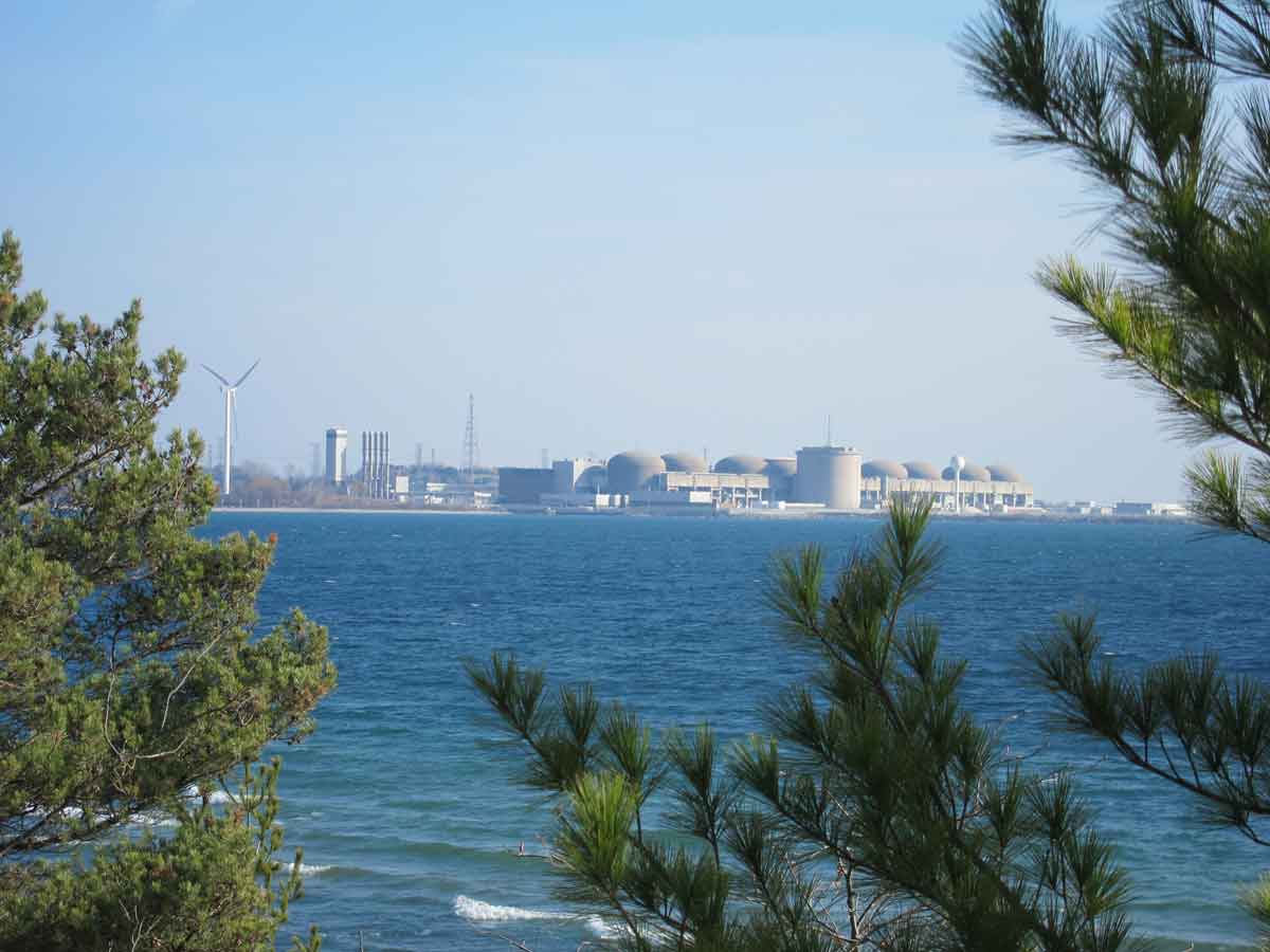
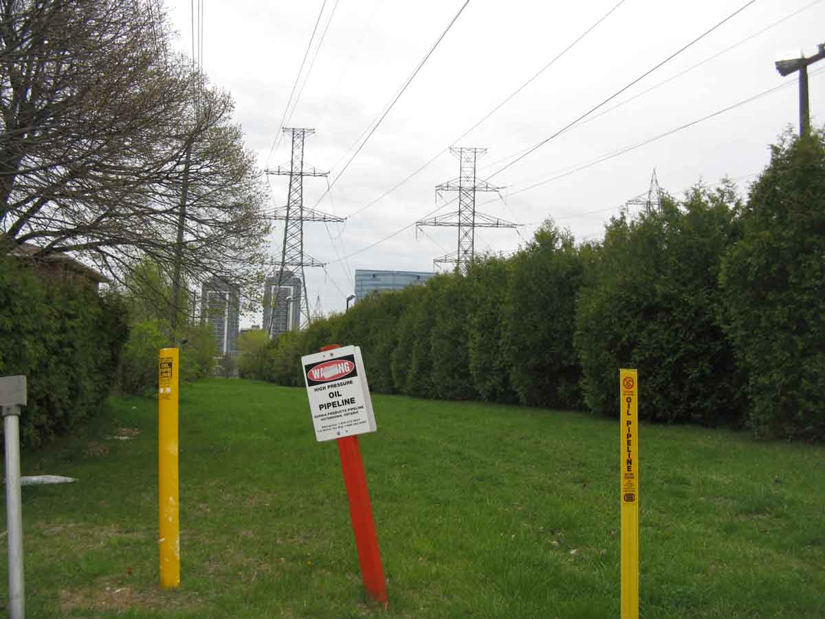
This is the Pickering nuclear power station seen from the waterfront trail. Oil and gas pipelines run beneath many of the hydro corridors, and are connected with continent wide pipeline networks. Gas comes from Alberta around the south end of Lake Michigan and through Sarnia, oil comes from the east coast, though there is a current and contentious proposal to bring that, too, from Alberta.
Highway Networks and Notes on Congestion
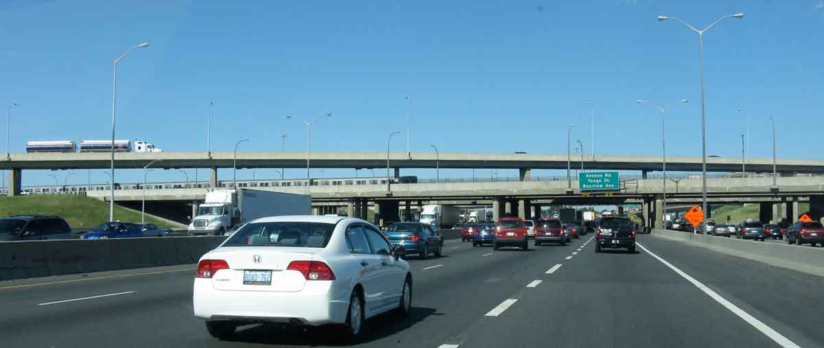
Roads and expressways form what are probably the most familiar networks in the Toronto region. Highway 401 is the busiest expressway in North America (though it competes with the Santa Monica Expressway in Los Angeles for this distinction), carrying almost half a million vehicles a day at its most travelled section. The Inautonews, 2011, List of World Record Highways that suggests the 401 is the longest length of highway with 10 or more lanes is at http://www.inautonews.com/list-of-world-record-highways. Traffic flows on Hwy 401 are available at Ontario, Ministry of Transportation, 2007 Ontario Provincial Highways Traffic Volumes on Demand.
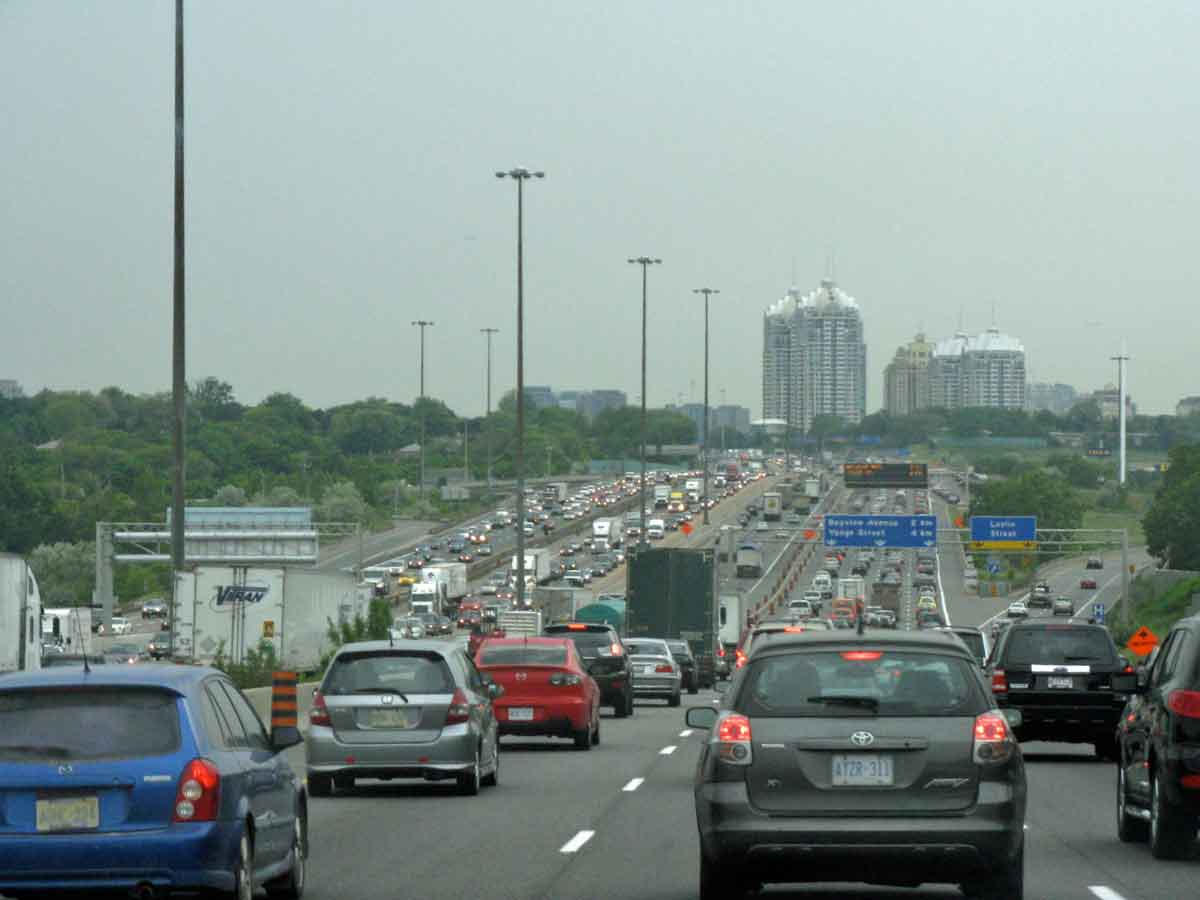
On the left is Highway 401at Leslie Street just east of Yonge, with 14 lanes of traffic, or 18 including entry/exit ramps. At the right is Highway 401 at Pickering Town Centre, with 14 lanes, paralleled by the GO and Via rail lines, and crossed by power lines leading out of Pickering Nuclear Power Station – three juxtaposed networks.
And here is Highway 401 at the Allen Road interchange, where it is also crossed by the Spadina Subway line.
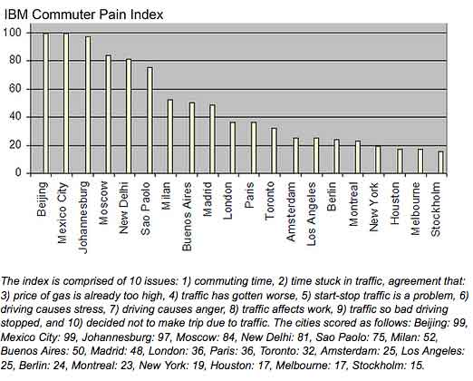
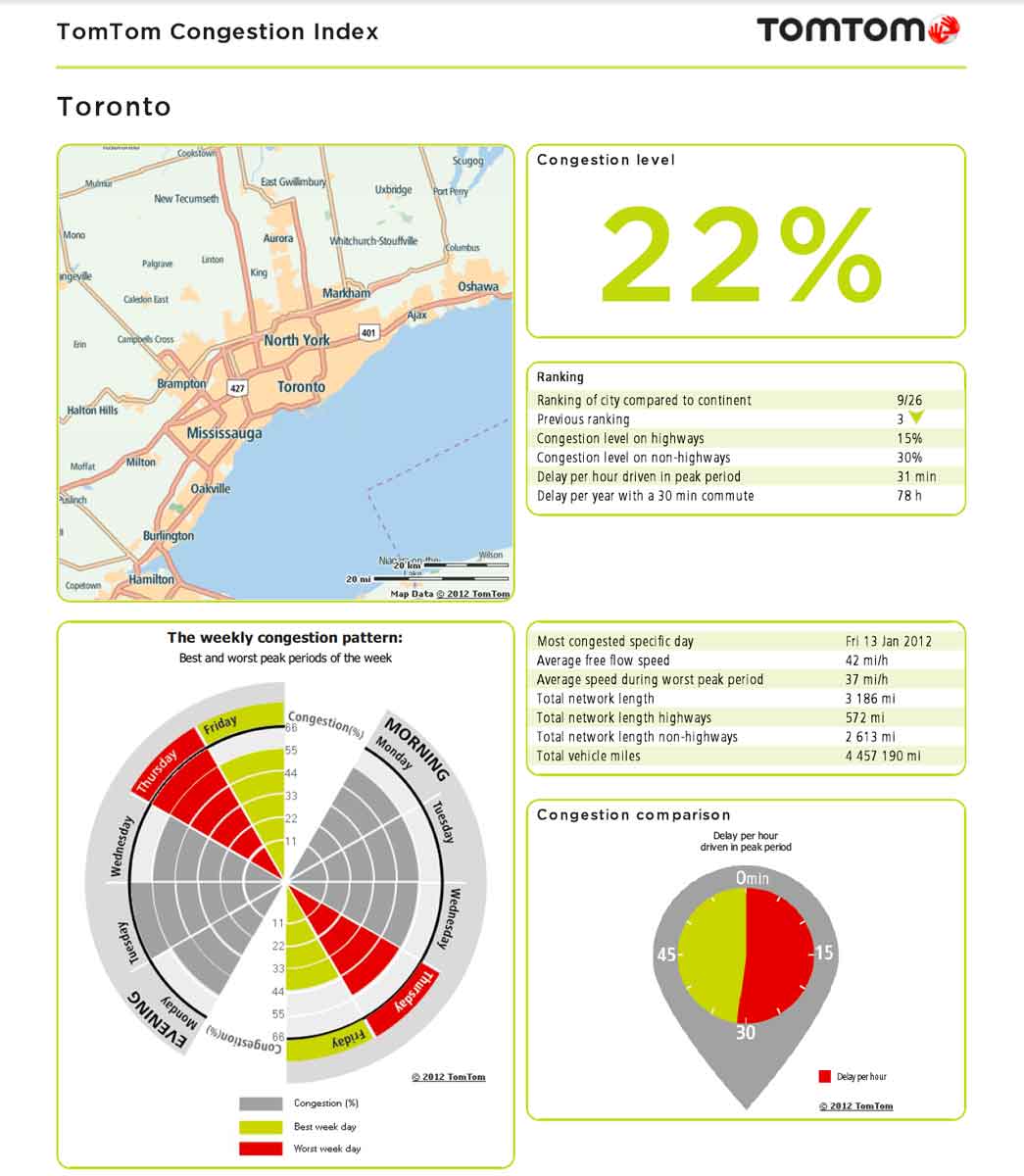
The network of expressways is a critical element in the urban structure of the Toronto region. Traffic congestion on them and on major arterials has become a serious issue, though just how bad it is relative to other cities depends on whose assessment you believe. According to the IBM global commuter pain index Toronto has the worst traffic congestion in North America. The Toronto Board of Trade agrees. But Tom Tom, using GPS data, rates Toronto 9th of 26 North American cities (Vancouver ranks 2nd).
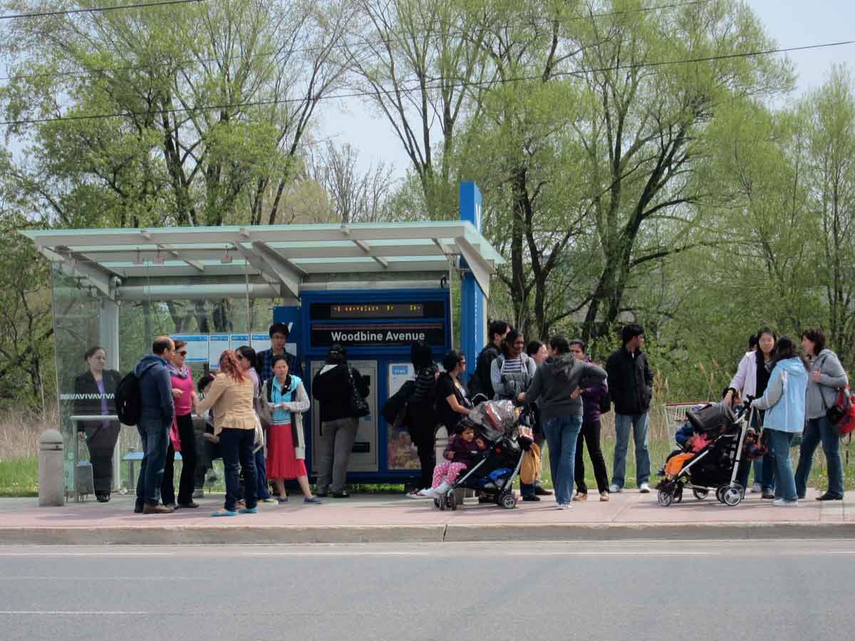
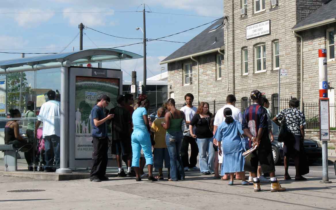
Most discussions of congestion are about highways, but a report by Statistics Canada (discussed in Chapter 7) indicates that the slowest travel times are those involving transit. Here are bus stops on Hwy 7 at Woodbine, and Eglinton and Dufferin, crowded with patient potential passengers.
Visible Networks of Identity
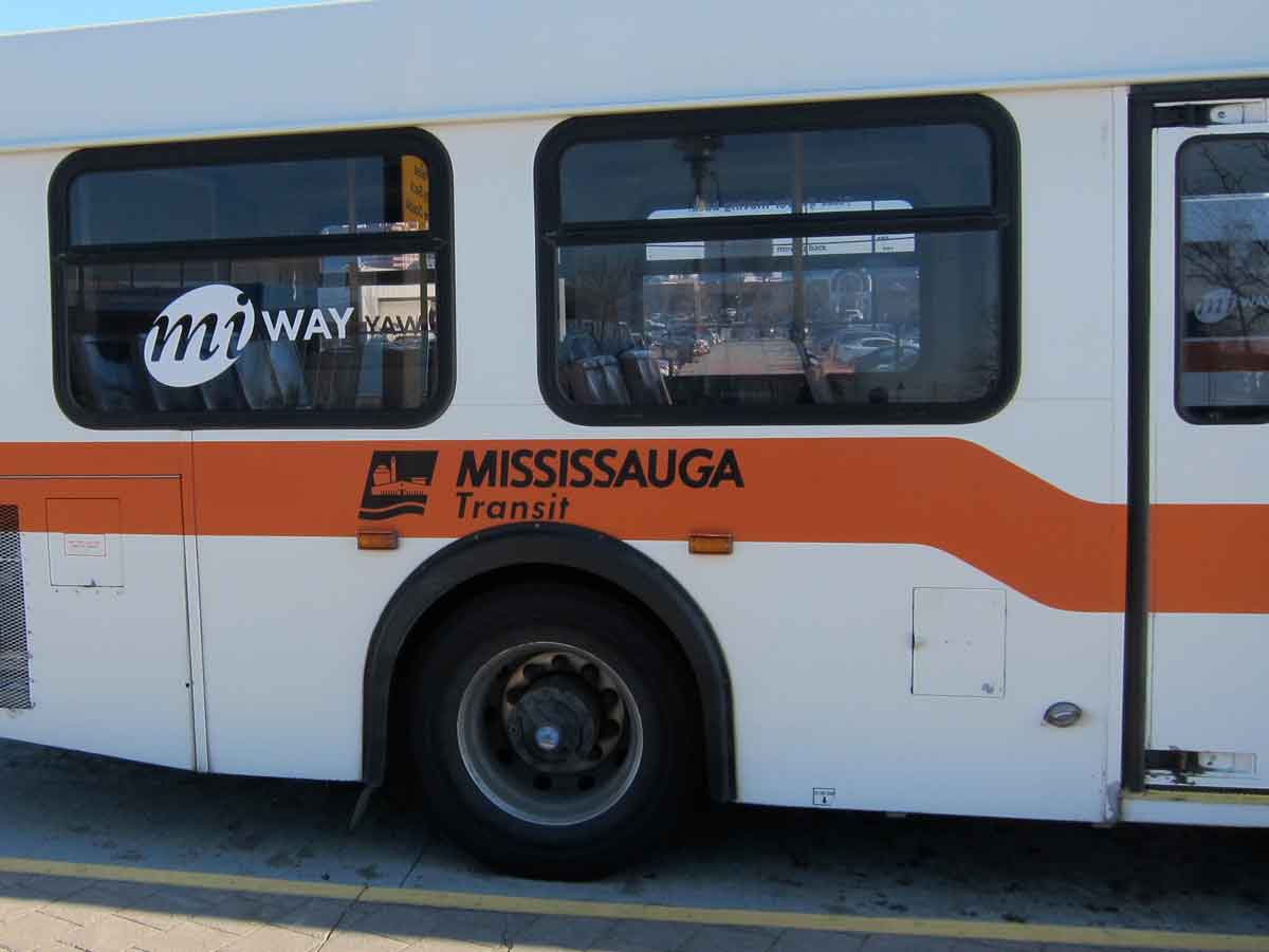
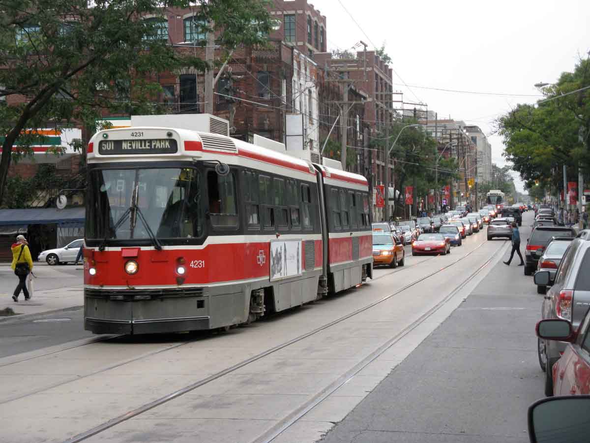
In daily life regional identity is constantly reinforced by visible local networks of regional chains and transit. Municipalities have their own transit brands.The nicely named MiWay of Mississauga, and the black, red and white of a TTC (Toronto Transit Commission) streetcar.
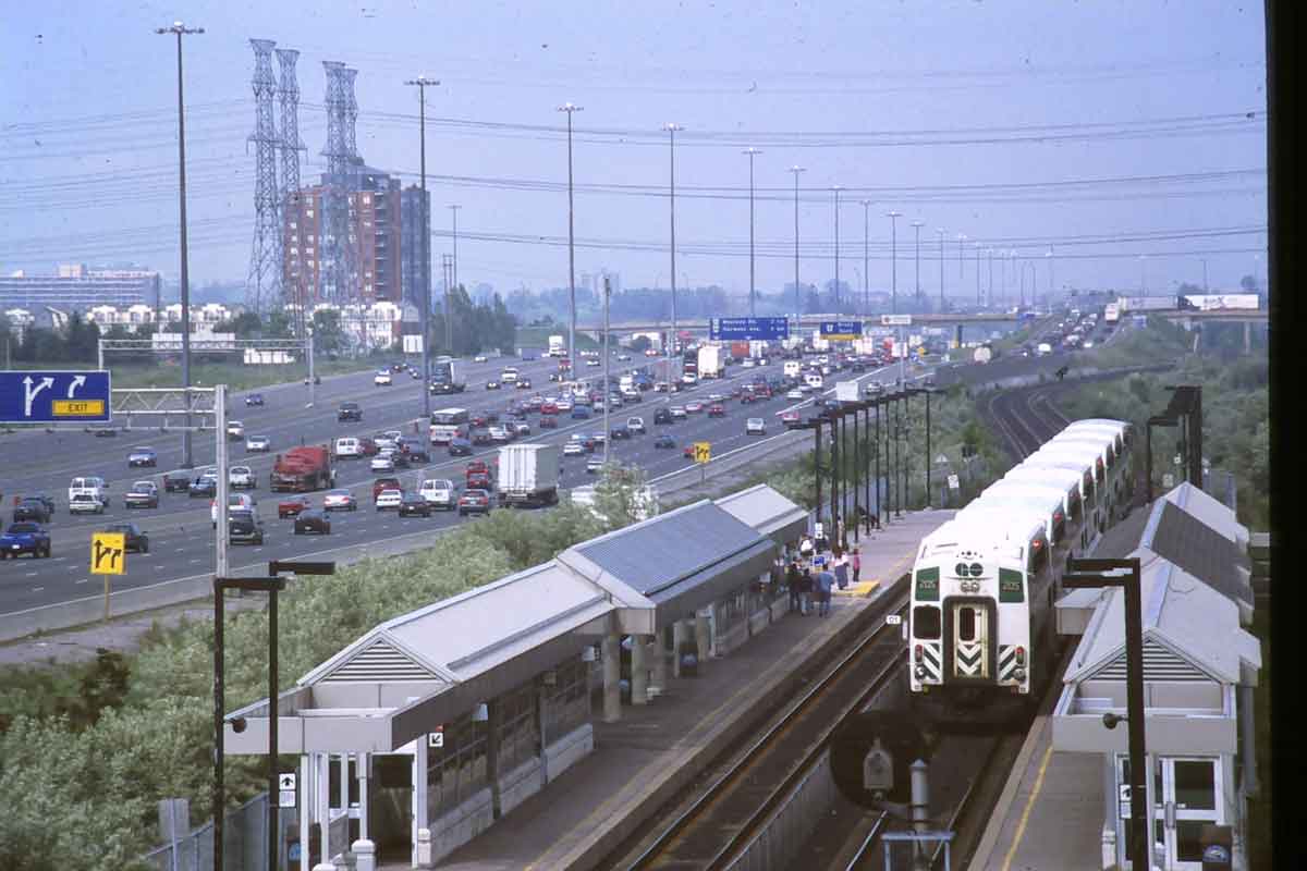
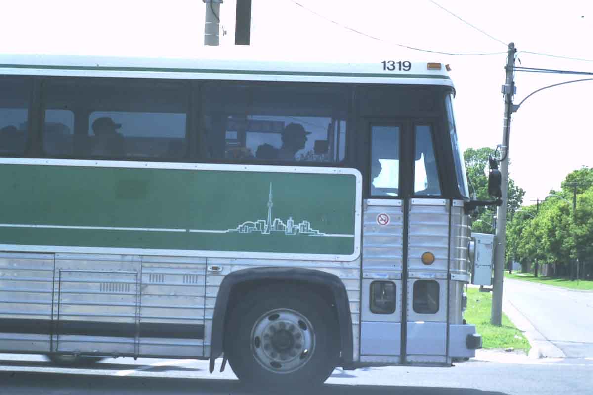
Probably the best single landscape marker of the Toronto region is the GO transit system. This map is from http://www.gotransit.com/publicroot/en/schedules/sysmap.aspx. The green and white trains and buses run almost to the end of the Greater Golden Horseshoe. These trains are waiting for evening rush hour just west of Union Station.
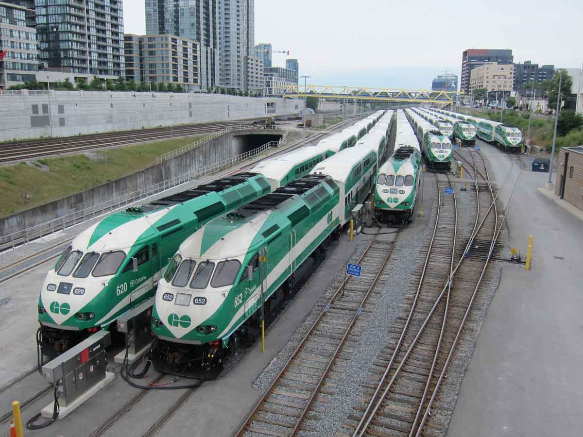
 Incidentally, although Union Station, in the heart of downtown, is emphasized with block capitals in this map, a number of GO bus routes link the outer and inner suburbs and by-pass the City of Toronto.
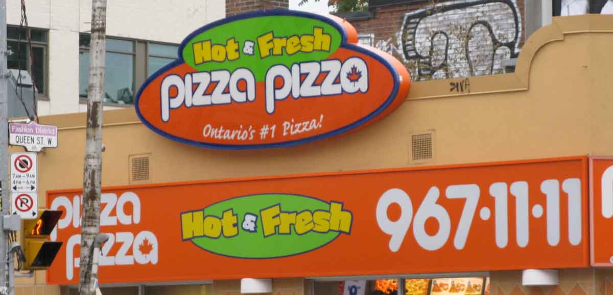
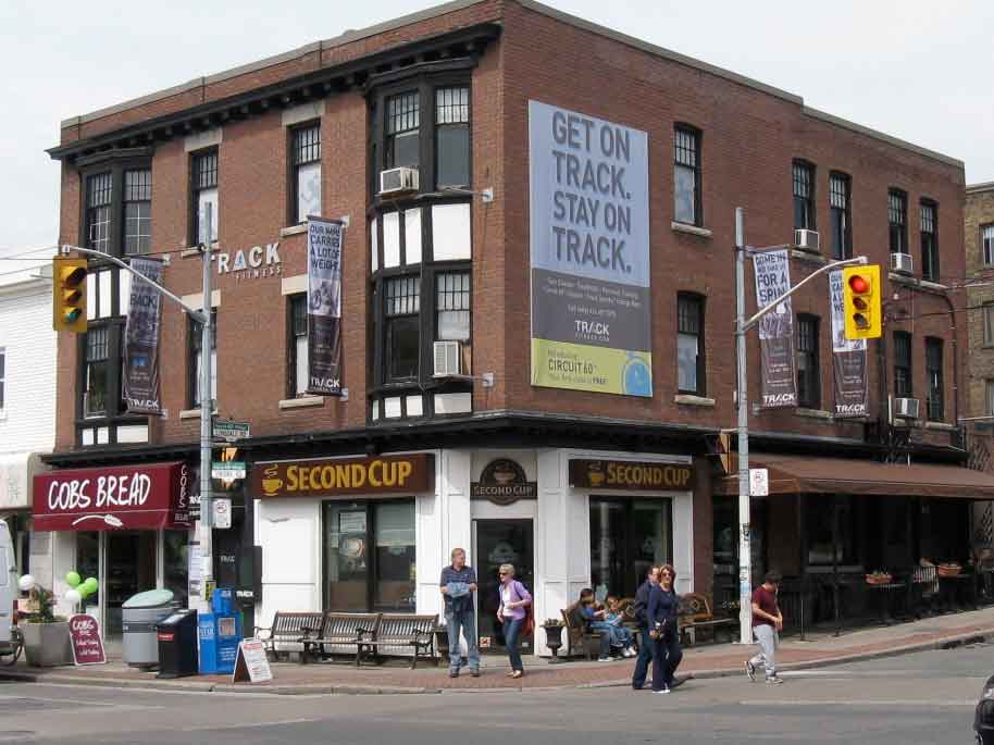
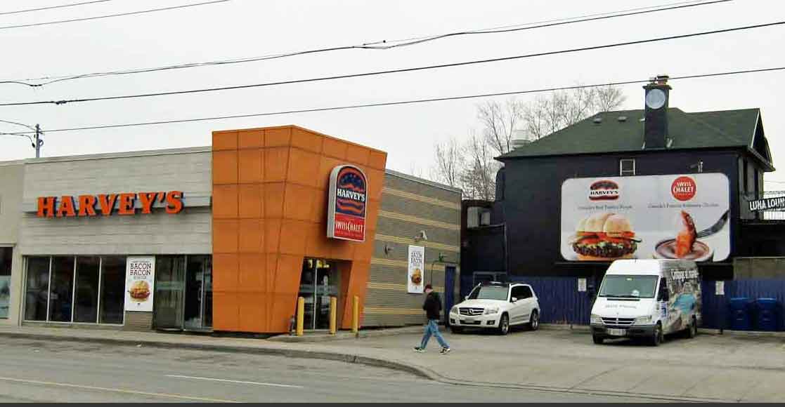
Supplementing the regional identities of transit system are networks of local retail chains. I discuss and illustrate Tim Horton’s in Chapter 7. Here are some others well known to Torontonians, less so to outsiders. Pizza Pizza began on Parliament Street in 1967; Sunset Grill has its original cafe on Queen Street in the Beaches and now about 20 franchises all within the region – this one is at Blue Mountain in Collingwood; Harvey’s and Swiss Chalet began respectively in Richmond Hill in 1959 and the old City of Toronto in 1954 and now sometimes share facilities; Second Cup is the local coffee house chain that began in Scarborough Town Centre in 1975 (but Cobs bread is a franchise bakery which originated in Vancouver).

Electronic Fields – Everywhere is now a Centre
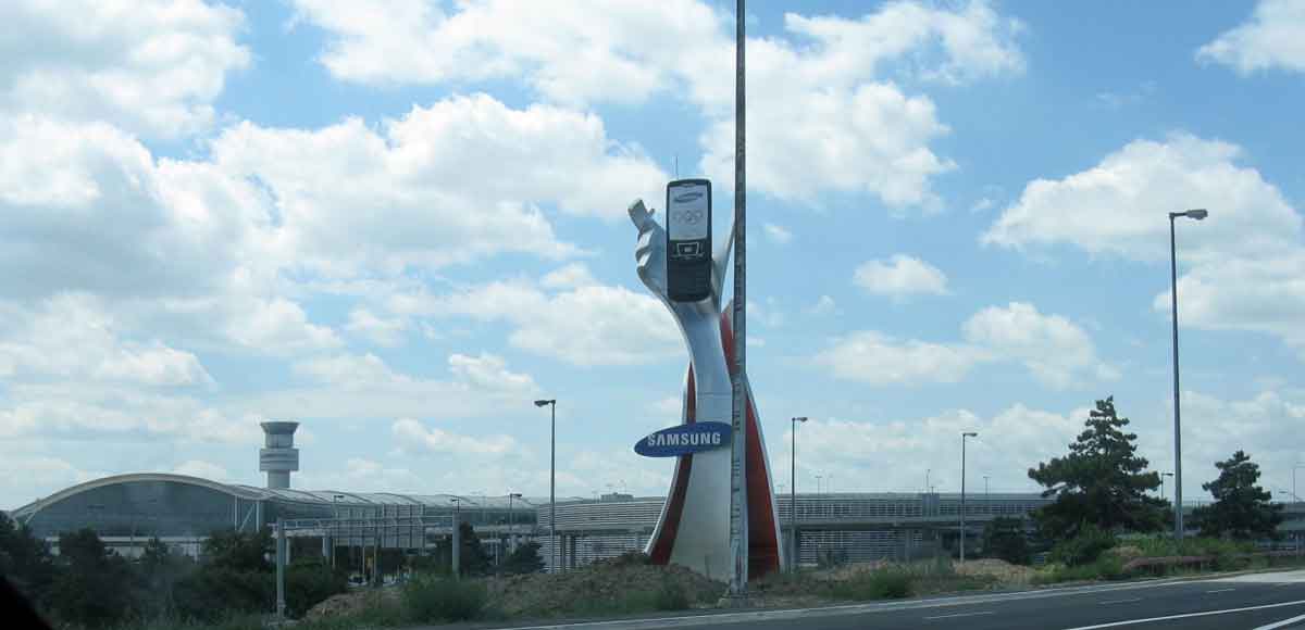
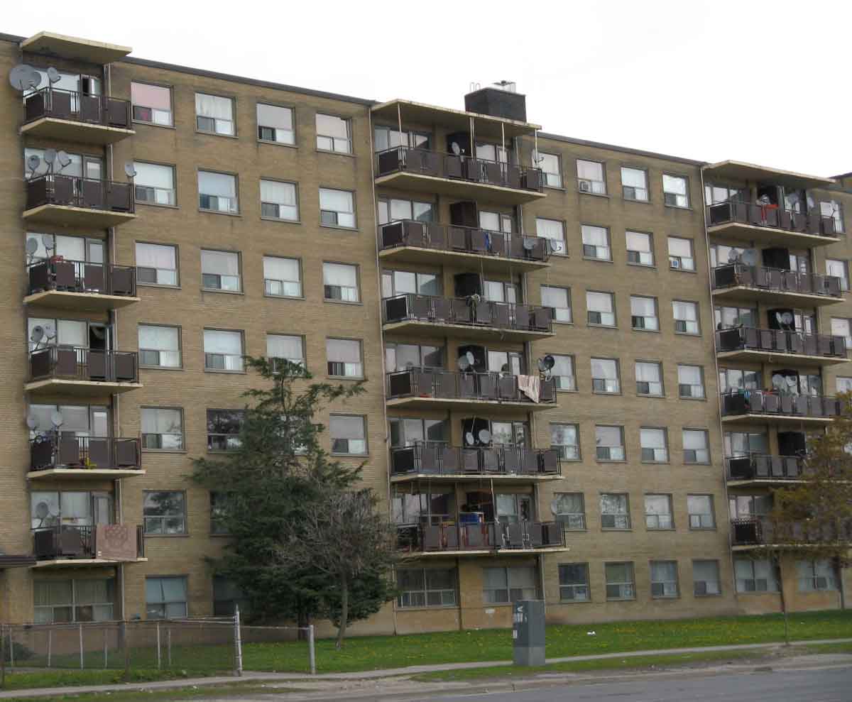
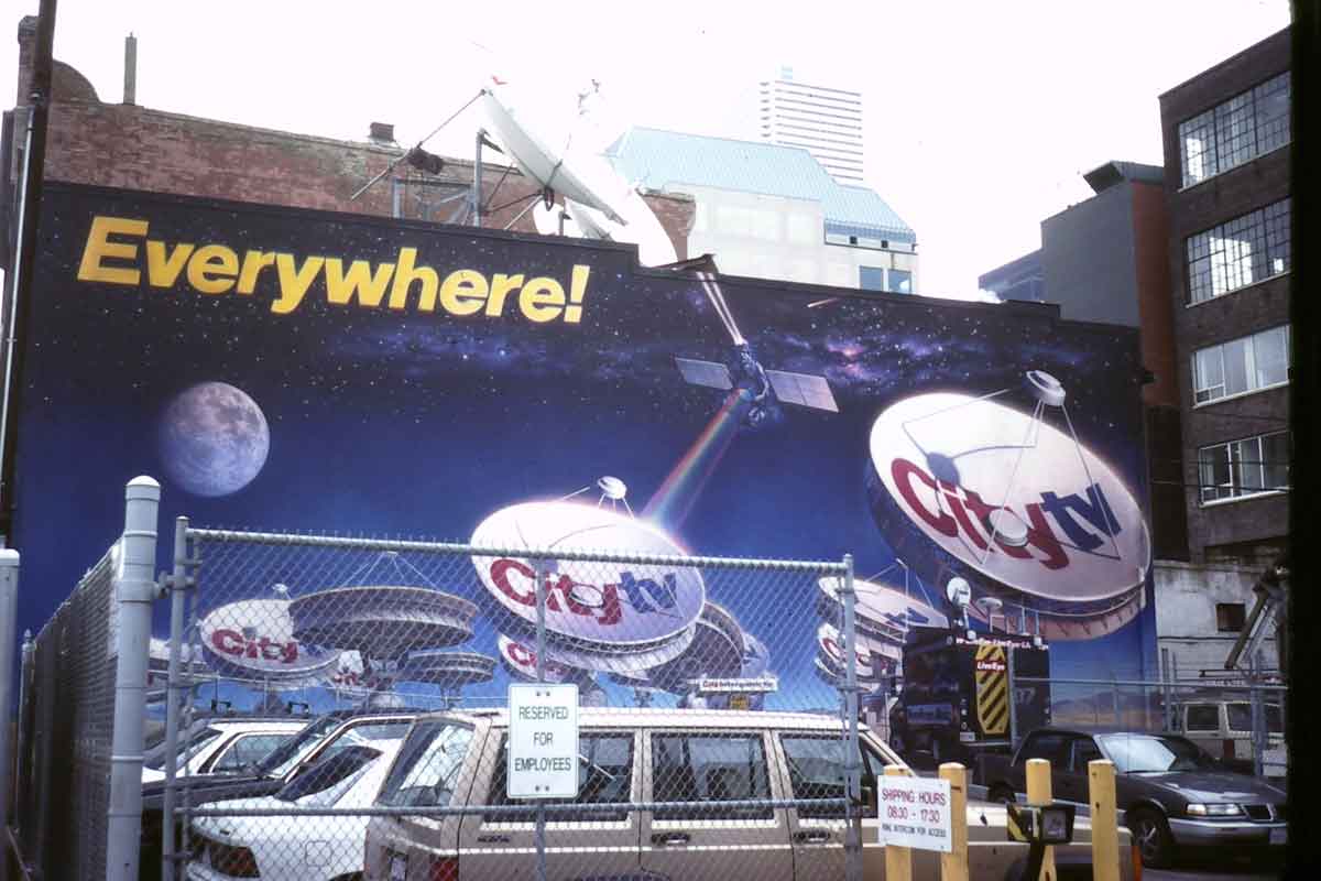
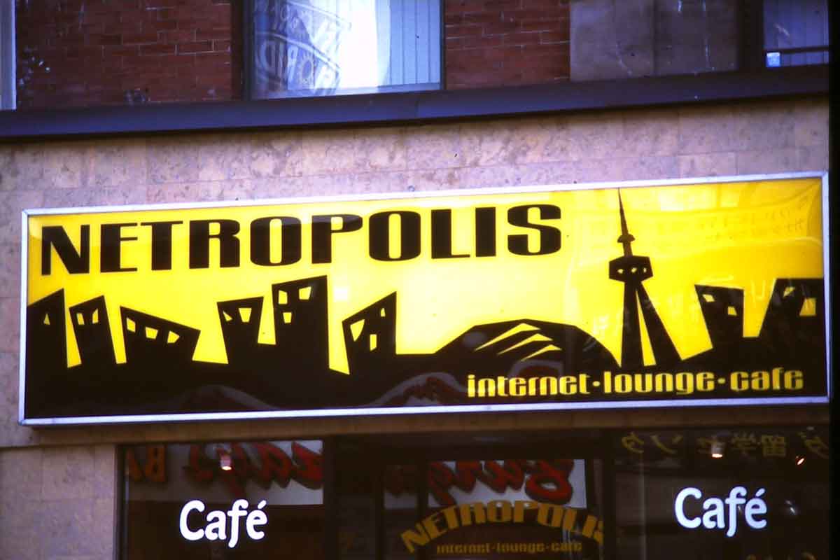
All these various networks are now overlain and interpenetrated by electronic communications, manifest only things like cell phone towers and satellite dishes. It is not yet certain how these are effecting urban forms, but there is no doubt that they are changing our experiences of cities. Here are some photos that capture some of this. The Samsung phone in the hand is on the approach roads to Pearson Airport; the apartment with (in this photo) 34 satellite dishes is on Lawrence Ave in Scarborough; City TV is a local channel based on Queen Street West; Netropolis with the CN tower sign was on Yonge Street south of Bloor. For me, these reinforce Marshall McLuhan’s observation, discussed in my book, that with electronic communications everywhere is now a centre.
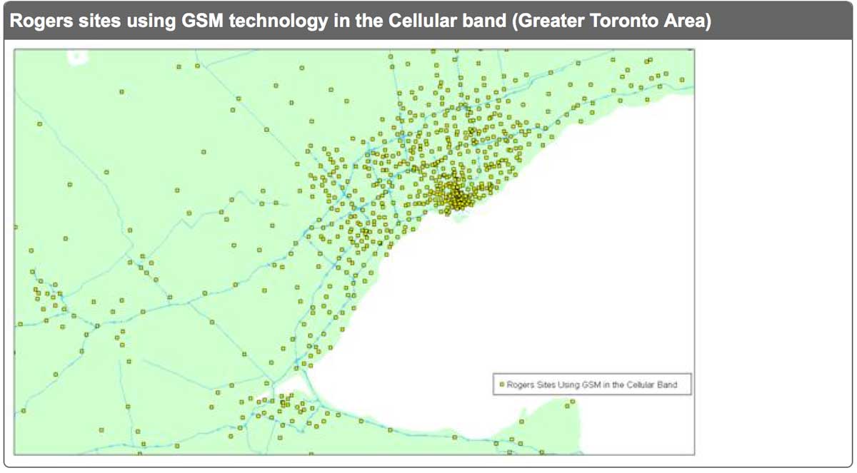
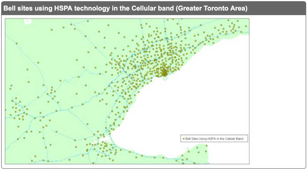
Here are maps of the mobile phone relays in the Toronto region for Rogers and Bell, two of the three major players in mobile phone services in Canada. GSM stands for Global System for Mobile Communications – the technology used by most cell phones, and HSPA means High Speed Packet Access. The maps are from a 2010 Industry Canada report on Spectrum Management and Telecommunications.
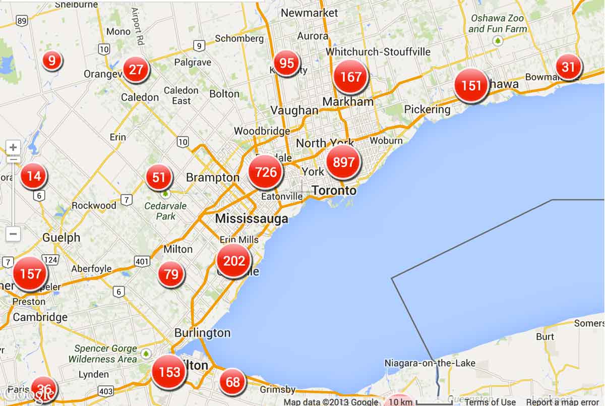
Finally, in October 2013 there were 2,863 cell phone towers and relays in the Greater Golden Horseshoe, the visible manifestation of an electronic presence everywhere, conveniently mapped by Loxcell. In the online version of this clicking on the red circles zooms in to ever greater levels of detail.