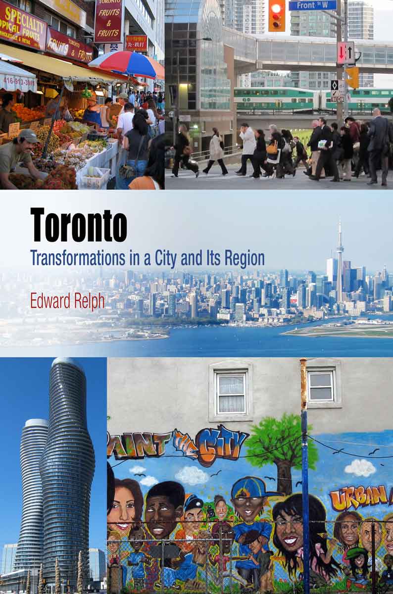
 This page is part of the companion website to my book Toronto: Transformations in a City and its Region, published by UPenn Press.
[NOTE: I have divided Chapter 6 into two web entries because I am using a lot of images. This part deals with the background issues and patches of residential, retail and industrial land uses. The next part examines different centres, the edge, and the exurbs]
Introduction
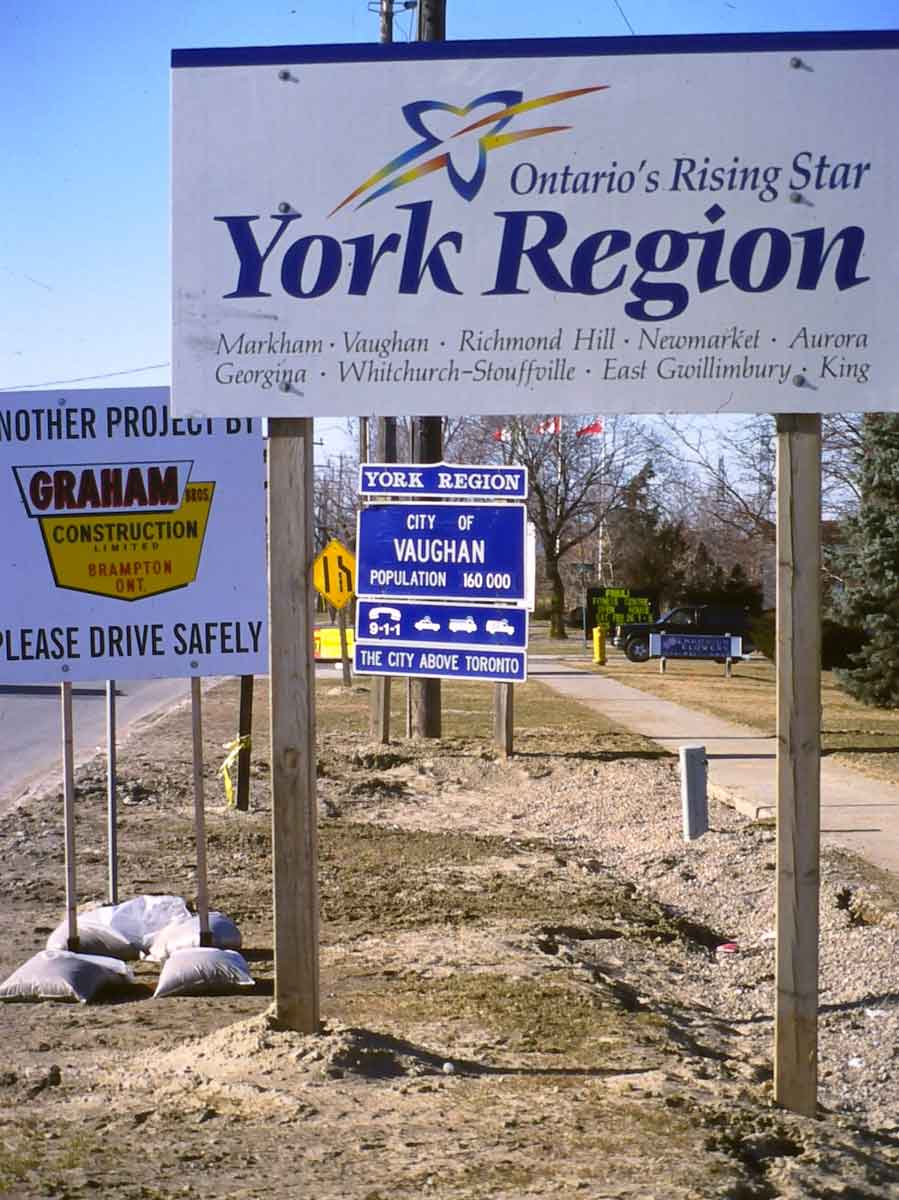
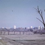
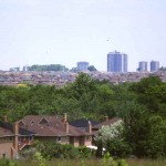
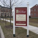
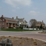
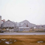
Toronto’s outer suburbs are, in a legal sense, not part of that city at all. They are the built-up areas adjacent to the City of Toronto that are located in four regional municipalities which have the same two-tier structure and authority that Metro Toronto had, and which effectively landlock Toronto. These regions and the towns and cities within them have a strong sense of their own identities, apparent in the slogans in the signs shown below (this was taken about 2006, at the border with Toronto; the branding has changed, though the sense of independence apparent in the clever claim that Vaughan is “the city above Toronto” has not).
The article in the Toronto Star comparing the areas defined by the 416 (City of Toronto) and the 905 (outer suburbs) area codes is available here
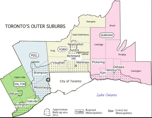
This is how it came about. In 1970 urban development had begun to spread beyond Metro’s borders and was mostly under the aegis of Metro’s extended planning powers. There were no formal regional plans, but Metro had proposed growth extending close to Lake Ontario with northward growth limited because of the difficulties of servicing for water supply and sewerage, both of which require access to Lake Ontario (see the entry for Chapter 4). Proposals (shown below) were made by the province for a Toronto Centred Region in the early 70s, advocating much the same idea. Instead the province provided funding for the construction of major sewers to service areas north and west of Toronto. These provided the foundation both for urban growth, and for the regional municipalities shown in the map above. Together, the sewers and the regional municipalities have directed the growth of the outer suburbs.
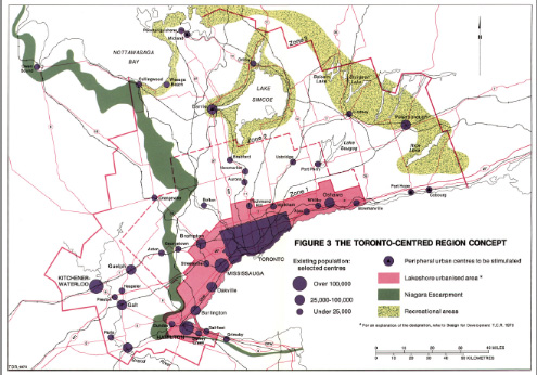
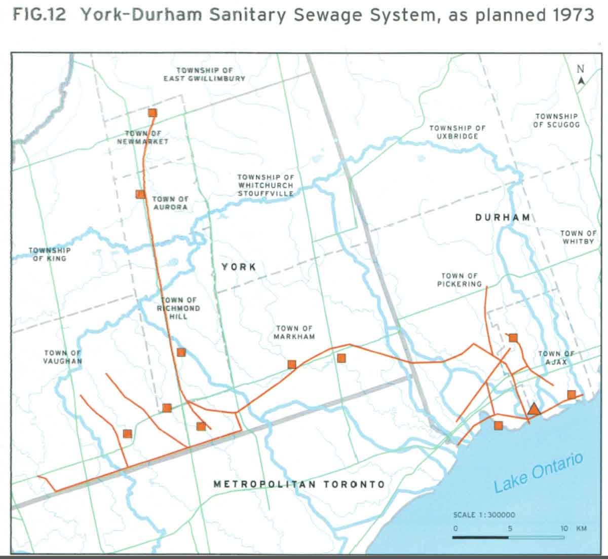
These two maps, of the Toronto Centred Region concept and the “big pipe” sewer (the treatment plant is the triangle on the shore of Lake Ontario) are respectively from Richard White’s The Growth Plan for the Greater Golden Horseshoe in Historical Perspective, Neptis, 2007, and his “Urban Infrastructure and Urban Growth in the Toronto Region 1950s to 1990s”, (Neptis, 2003).
Notes on sprawl and not-sprawl
Here are the data I used to conclude that the notion of sprawl, when understood as built-up area growing faster than population and applied to the Toronto region, is enigmatic and not a useful way to think about the development of the outer suburbs.
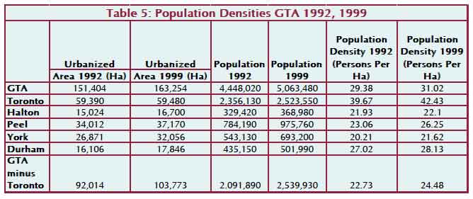
This table from GHK, “Growing Together,” 2002, show increases in density in all parts of the Toronto region; the urbanized area of Toronto grew by 1%, population by 7%; the urbanized area of the rest of the GTA (outer suburbs) grew by 12%, population by 21%. (Ha = hectares)
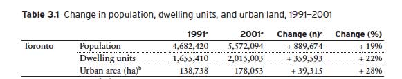
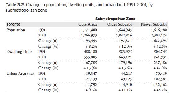
Tables from Taylor and Burchfield, Growing Cities (Neptis: 2010). 3.1 shows the overall area growing 9% faster than population. 3.2 shows the core area grew 1% faster than population, and the area of newer (outer) suburbs grew 3% faster than population.
In my book I use data from City Mayors, and Demographia, two websites that attempt to measure urban densities in consistent ways, to compare the Toronto region with other cities to show that it is the most densely populated metropolitan area in North America, about the same as Los Angeles, and similar to Copenhagen in Europe.
The Background Matrix
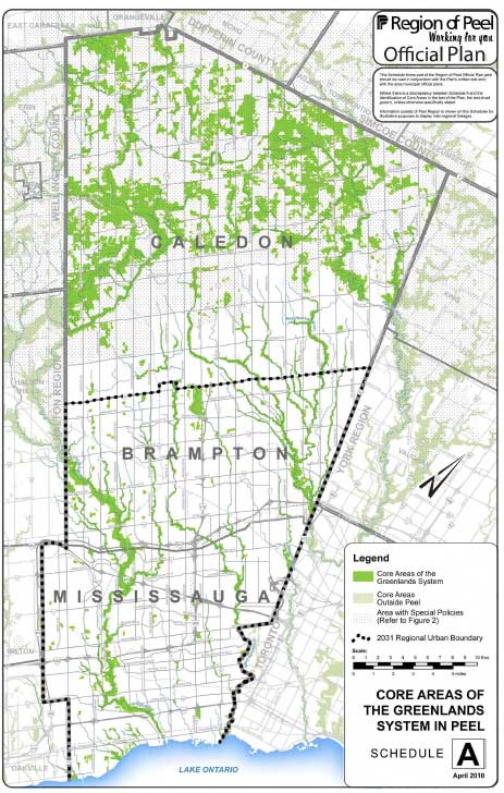
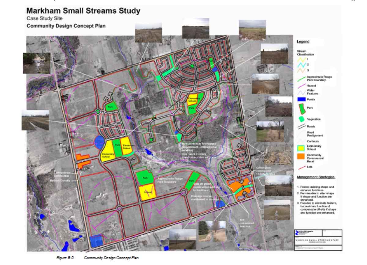
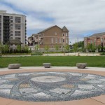
The two illustrations below demonstrate clearly that the matrix of the outer suburbs consists of both green corridors and the megagrid of arterial roads. The one on the left is from the Peel Region Official Plan, 2008; the one on the right shows a concept plan from the Markham Small Streams Study, 2006 (available at City of Markham, then search on Small Streams Study for the pdf). The latter shows a community within the grid of arterials that is planned to protect the watercourses. The role of arterials and green corridors in Markham is also very clear in the slides for a 2011 CIP conference presentation on Managing Growth in Markham.
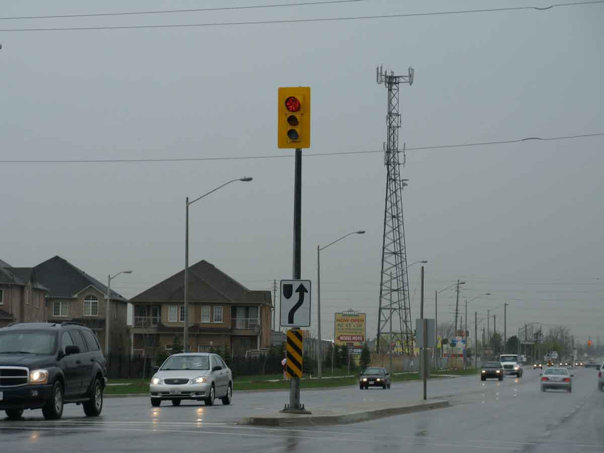
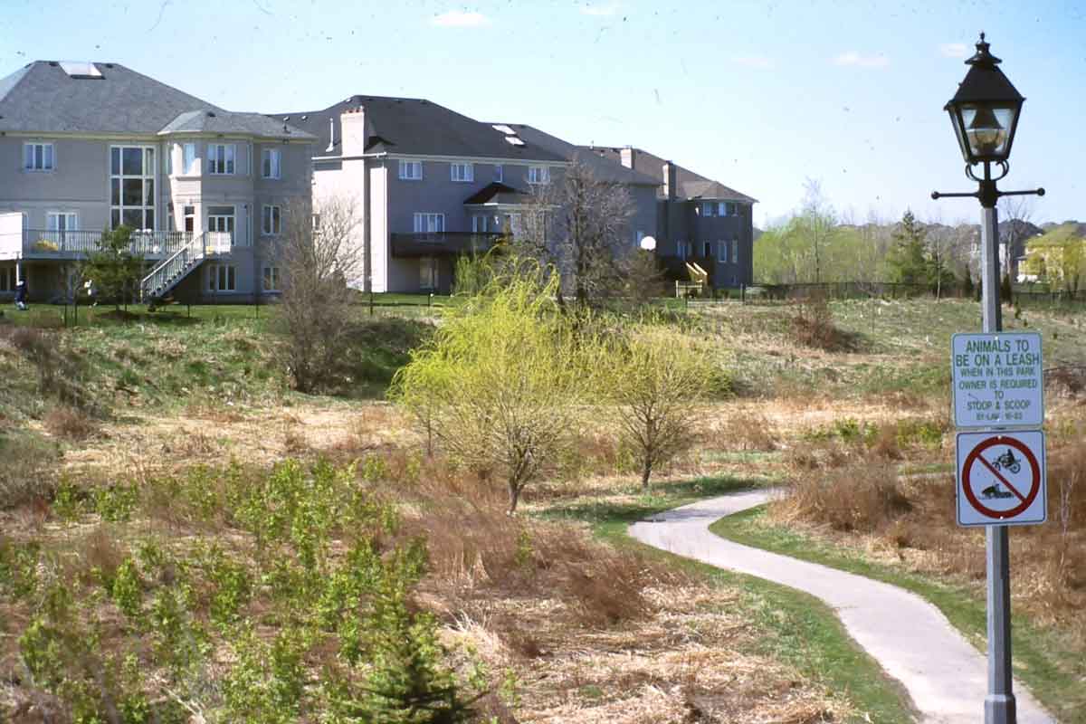
While arterials are the easiest way to move around the outer suburbs, they are also probably the least attractive. They are really traffic and service corridors that give little impression of what is happening within the blocks they create. On the left is an example from north Brampton (with a cell phone tower that is a key element in an even more flexible medium of communication). On the right is a green corridor in Bayview Hills in Markham, protected as a watercourse and used for recreation.
Diverse Patches of Dwellings
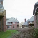
Contrary to the idea that seems to have been held by Jane Jacobs (as cited in Chapter 6), among others, the outer suburbs do not consist of a sea of single-family detached houses with large lots and double garages and gated communities are uncommon. Almost everywhere there is a mix of houses of different sizes, townhouses and apartments, occurring in patches framed by the megagrid of arterials.
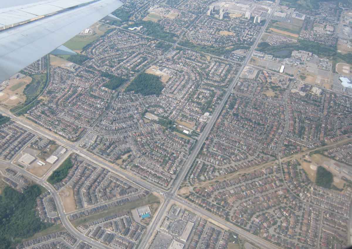
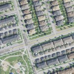
This view of the residential area around Steeles Ave West and Chingacousy Road in Brampton shows small detached houses on small lots (side-yards in much of the outer suburbs are about 1 metre), with clusters of apartment buildings. The diagonal strip across the intersection is a hydro corridor with walking/biking trails.
This gallery of photos gives an indication of the variety of outer suburban residential landscapes.
-
- Entrance to Vales of Castlemore, Brampton, where in 2006 the population was 80% visible minorities, mostly South Asian.
-
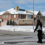
- Newmarket – street widths have to allow for snow storage
-
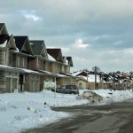
- The Manors of Corsica townhouses at Maple in Vaughan
-
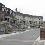
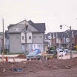
- Large houses under construction in Mississauga, about 2000. This gives some sense of how small the lots are, even for houses of this size.
-
- A mixture of townhouses and mid-rise apartments adjacent to a park with a traditional Chinese pebble installation in Markham near Warden Avenue.
-
- The plan for Swan Lake on 16th Ave in Markham (from a marketing prospectus). One of the few gated communities in the outer suburbs, the lake is a former gravel pit, private streets have substandard widths.
-
- An over-wide street in Brooklin, Whitby. Traffic engineers have an inclination to make streets wider than needed.
-
- Cooksville in Mississauga, seen from Hwy 5, in 1973. High-rise apartments have long been part of outer suburban residential landscape.
-
- Richmond Hill – single family houses and high-rise apartment seen from the Oak Ridges Moraine.
On the basis of data at skycraperpage.com I claim in Chapter 6 (and footnote 10) in my book that if the outer suburbs were a single city it would rank seventh in the world for the number of skyscrapers. But I now see that the 2013 data shows 534 highrises, thus the outer suburbs would rank 14th globally, still above Sao Paulo, but below Montreal, Vancouver, London and Los Angeles. These apartment concentrations are illustrated in the entry on this website for “Chapter 6 Part 2 : Centres.”
Ethnic Diversity and Visible Minorities
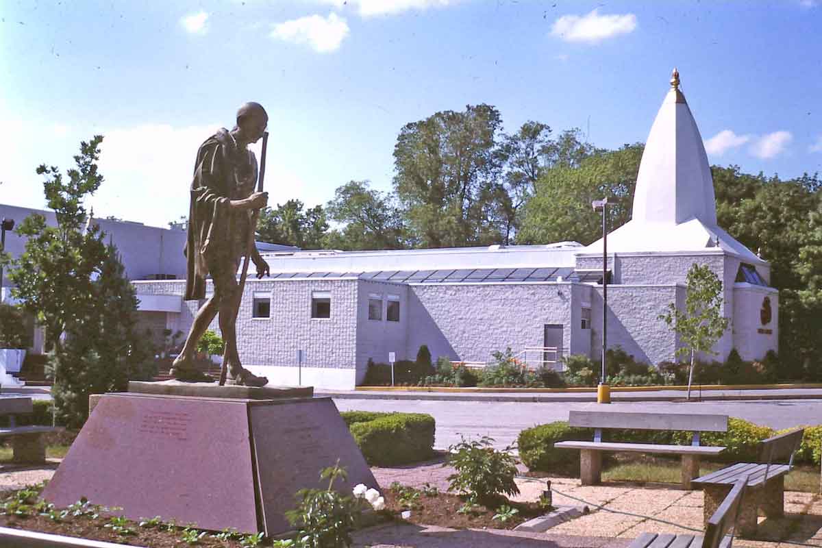 In residential areas the ethnic diversity of the outer suburbs is not clear, though indications of it area apparent in other land uses, such as temples and mosques. The Hindu Temple on the right is in Richmond Hill. The two maps below show diversity throughout the region and its particular prominence in the outer suburbs. The map from Statistics Canada, 2006, shows areas with more than 30% visible minorities in the Toronto CMA in the darkest shade. It’s a bit distorted because census tracts in the outer suburbs are larger than those in the City, though their population may be lower, but it clearly conveys the sense that the highest proportions of visible minorities are in the inner and outer suburbs. The map of Ethnic Enclaves, also from 2006 census data (from a presentation by Mohammad Qadeer and Sandeep Agrawal on Ethnic Enclaves in the Toronto Area) shows clusters of particular ethnic groups (though again there is an issue of over-emphasis because of census tract size relative to population size).
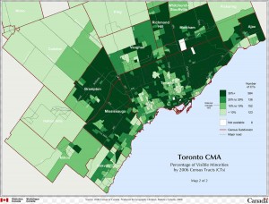
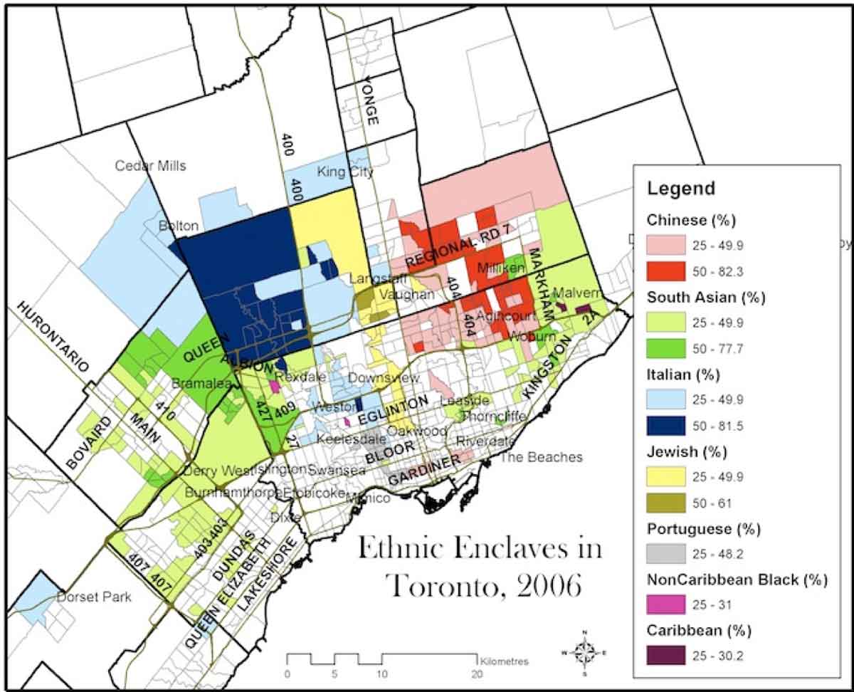
The Statistics Canada 2006 map of visible minorities is available at http://www12.statcan.ca, go to 2006 Census, then geography products, then thematic maps, then census metropolitan area/toronto/visible minorities2.
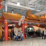
Religious Buildings and Faith-based Subdivisions
In the inner suburbs, which were developed at a time of declining Christian congregations, there are insufficient sites zoned for religious buildings in residential areas. But with immigration since 1970 the demand for sites for mosques, churches and temples has increased and many new religious buildings have had to be located in industrial or commercial districts. This is not the case in the outer suburbs, where temples and churches are often the most distinctive buildings in residential areas. In several cases they have been built before the houses and have attracted faith-based communities around them. Here are several examples.
-
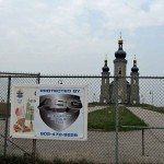
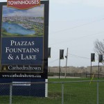
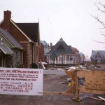
- Slovak Cathedral of the Transfiguration in Markham, 2008, now the focal point in Cathedraltown
-
- Cathedraltown sign, 2011.
-
- Cathedraltown streetscape, 2011.
-
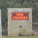
- Bulletin board for Chabad Lubavitch Jewish community in Thornhill, Vaughan.
-
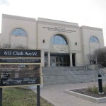
- Synagogue in the heart of the Chabad Lubavitch community.
-
- Ahmaddiya Mosque under construction in Vaughan in the mid 1990s.
-
- St Francis of Assisi church as the focal point at the end of the street entering Vellore Village in Vaughan.
-

- Sikh temple on Airport Road in Brampton in 1990s. There is a barn in the background. The area is now completely developed.
-
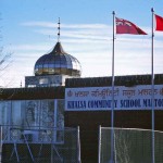
- Khalsa Community School, Malton in Brampton
New Urbanism and Related Developments
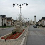
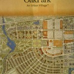
New urban or neo-traditional forms of residential development have become increasingly popular since 1990, and patches of them occur throughout the outer suburbs. (There is also one new urbanist project in the City of Toronto, on the former Woodbine racetrack). The City of Markham, in particular, has enthusiastically embraced new urbanism, apparent, for instance in the neo-Georgian streets of Cathedraltown, illustrated in the entry for Chapter 6 Part 1 as a faith-based subdivision, and in its new downtown, illustrated under New Centres in this entry. Andres Duany has been a frequent consultant for the municipality. Cornell was Markham’s first major new urbanist project and the driving principle is captured in the slogan “We have seen the future and it is the past”, illustrated below. Information about Markham and new urbanism is available at Markham’s New Communities Profile, and Built Form, Height and Massing Study.
Elements of new urbanist designs, such as rear laneways, are now being used by many local developers, especially when houses faces onto collector roads because they reduce driveways and turning movement, but also in other ways, that are combined with more conventional urban forms.
Peter Calthorpe’s plan for Langstaff is a pdf most easily accessed at http://www.markham.ca and then searching for Langstaff Master Plan Project. A 2005 article by David Gordon and Shayne Vipond in the Journal of the American Planning Association on new urbanism in Markham is available at http://www.tandfonline.com/doi/abs/10.1080/01944360508976404.
-
- Oak Park, Oakville, Plan about 1995
-
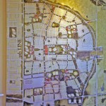
- Section of Oak Park showing rear laneway with detached garages
-
- Plan for Cornell, Markham, begun about 2000.
-
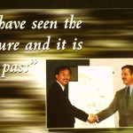
- A promotional poster for Cornell, about 2002, showed Larry Law, the developer, shaking hands with Andres Duany.
-
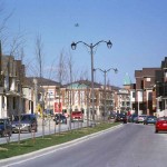
- A major street leading into Cornell, about 2006.
-
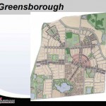
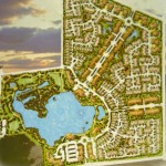
- Plan for Greensborough, Markham.
-
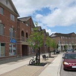
- Retailing at the centre of Greensborough, a large scale new urbanist development adjacent to Cornell, 2011.
-
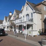
- The Village near Niagara-on-the-Lake, at the edge of the Greater Golden Horseshoe.
-
- New urbanist style street front retailing, Frenchman’s Bay, Pickering
-
- Mixed convential and new urbanist housing, Richmond Hill
-
- Axonometric drawing of Peter Calthorpe’s plan for Langstaff at Yonge and Hwy 407 shows different take on new urbanism.
-
- Heritage Estates in Markham consists of old houses, threatened with demolition, that have been moved to a dedicated small subdivision.
Heritage Estates, which is a sort of sanctuary for heritage houses threatened with demolition that have been moved to the site, is not strictly new urbanist but seems to me to be in the same neo-traditional spirit. The aerial shot of a section on Bantry Avenue in Richmond Hill shows how new urbanist layouts (the ones with rear laneways, adjacent to the collector) are being combined with conventional single-family detached houses. Presumably this gives a more urban appearance to the collector streets, yet also reduces driveways and curb cuts, and so reduces the likelihood of accidents.
Retailing in the Outer Suburbs
Most retailing in the outer suburbs is along commercial strips, in plazas, big boxes or malls, but in addition to the relatively few sections of street-front shops in new urban developments (such as those shown above) there are some interesting exceptions.
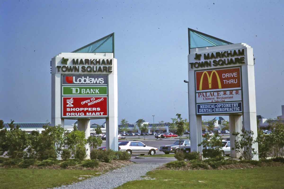
A creative use of the idea of the town square. An otherwise conventional plaza in Markham – lots of parking with stores on the edges
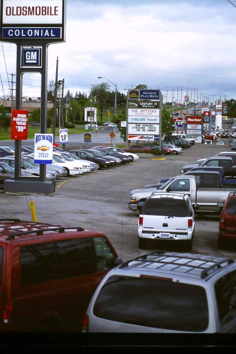
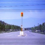
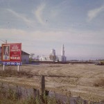
An outer suburban commercial strip – Yonge Street in Newmarket in the 1990s. Part of Upper Canada Mall is just visible on the left.
-

- The penguins greet shoppers at the entrance to Smart Centre (a Toronto region retail developer) plazas. (This is actually in the inner not the outer suburbs, but the penguins are the same in both)
-
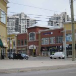
- A new retail street in Thornhill. This has parallel parking and the same form as a traditional main street….
-

- But this is the view behind the new retail street – a conventional plaza, lots of parking and (to the left of this photo) big box stores.
-
- 1. Weal and Cullen Barns.
-
- 2. Enclosing Market Village, 1992
-
- 3. Pacific Mall, opened 1997 on the site of Weal and Cullen Barns.
-
- 4. Inside Pacific Mall, lower level.
-
- 5. Inside Pacific Mall, upper level, the entrance to Heritage Town.
-
- Jaipur-Gore Plaza in Brampton has this Hindu temple in one corner (from Google Street View)
But not all retailing is entirely conventional. In a large new retail development in Thornhill in Vaughan Smart Centres (a Canadian retail developer headquartered in Vaughan) has built the new public shopping main street shown above, albeit as the central feature of a big box plaza. And in the outer suburbs where there are substantial new immigrant populations there are plazas and malls with distinctive ethnic identities. Pacific Mall, which claims to be the largest Chinese mall in North America, has a particularly interesting, postmodern history, illustrated in the photos above. In the 1980s there was a sort of rural romantic WASPish shopping centre here – Weal and Cullen Barns, with a garden centre, petting zoo, produce market, craft shops. About 1990 Market Village was built as a disneyish outdoor shopping centre with pedestrian only streets and facades of small scale southern Ontario architecture. But a recession occurred in the early 90s and Market Village floundered at precisely the same time that the immigrant Chinese population in adjacent areas was growing. Chinese developers bought Market Village, turned most of it into a enclosed mall (the photo above shows the beginning of the process), then demolished Weal and Cullen Barns and replaced them with Pacific Mall, an east Asian style Chinese mall with Heritage Town as the food court. It has flourished.
Industrial and Employment Landscapes
Over half the jobs in Toronto’s metropolitan area are in the outer suburbs. Since the 1950s the region has been an important North American centre for automobile and truck manufacturing. Ford (Oakville), GM (Oshawa), Chrysler (Brampton and Honda (Alliston) all have major assembly plants here. Magna International, the largest auto parts manufacturer in the world, is headquartered in Aurora.
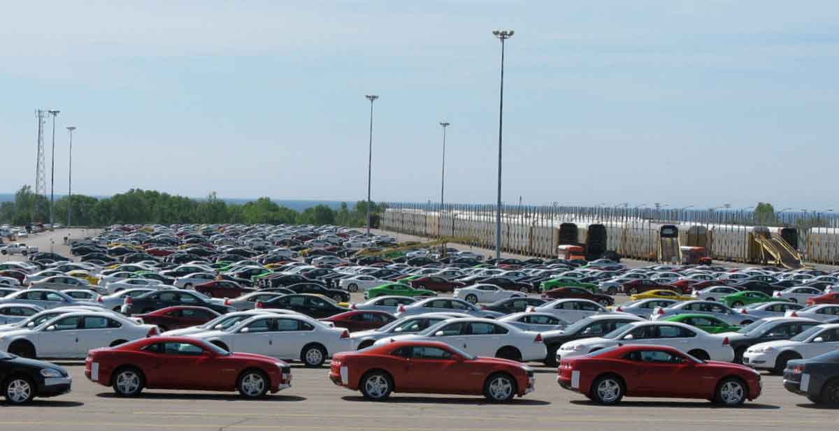
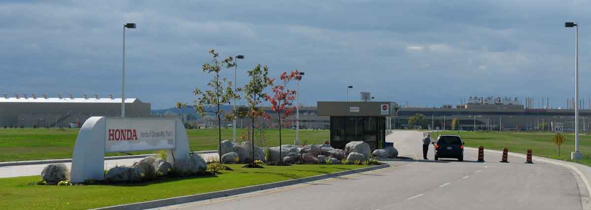
New cars at the GM plant in Oshawa waiting to be loaded onto railway carriers (middle right), and the entrance to the sleek Honda plant in Alliston.
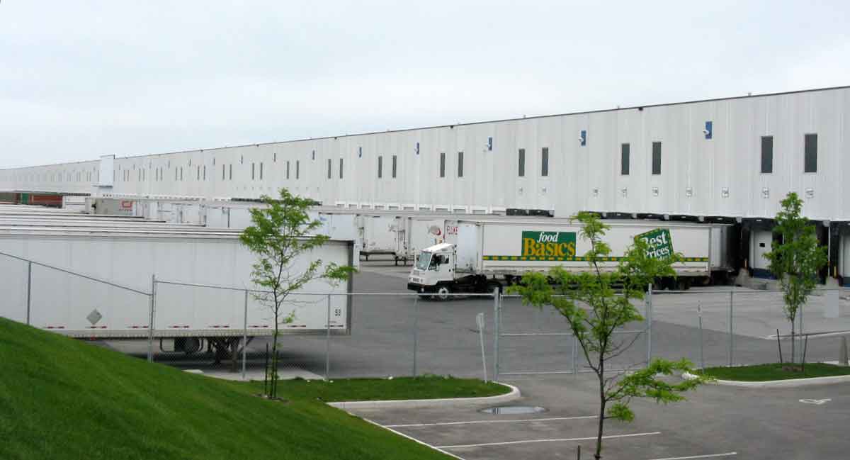
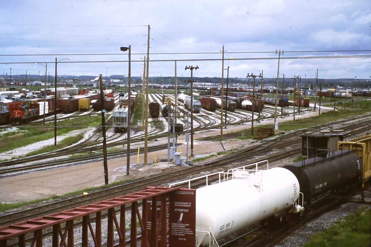
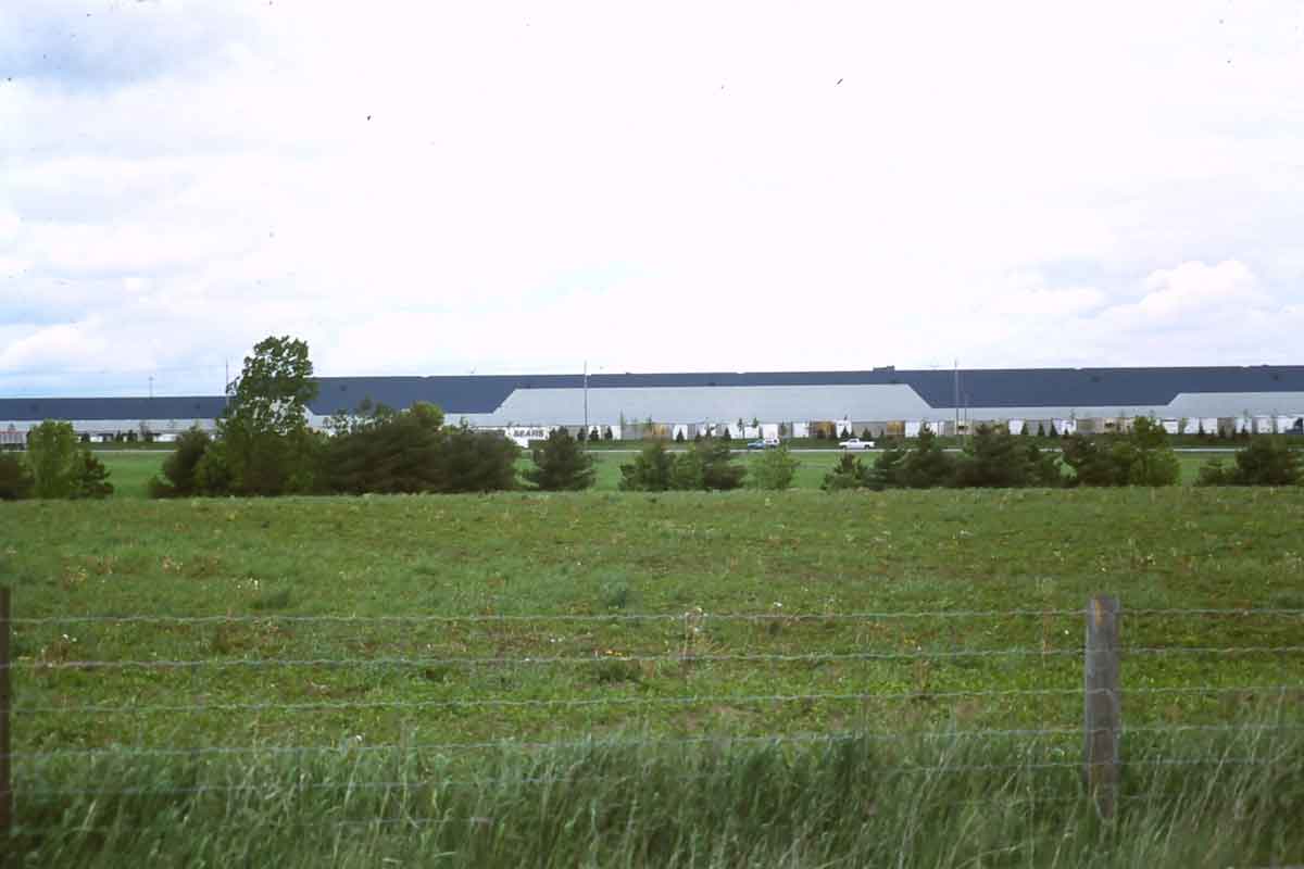
Automobile assembly plants are large exceptions to the more common industrial landscapes of the outer suburbs, which consist of distribution centres and manufacturing buildings similar to this distribution centre in Brampton – long, low, pale colours and lots of space for trucks. Many of these handle goods brought in by rail from Vancouver or Montreal to rail yards, such as this one at Concord in Vaughan, or intermodal facilities. The photo on the left below shows the Sears distribution centre at the CP intermodal on Hwy 50 in Vaughan – a building that is over a kilometre long.
There are also office or business parks, such as Valleyfield near the intersection of Hwy 404 and Hwy 7 in Markham, shown on the right above, or adjacent to Hwy 401 near the airport in Mississauga, apparent in the clusters on the map on the right below (which only shows Canadian head offices- there are many other mid-rise office buildings).
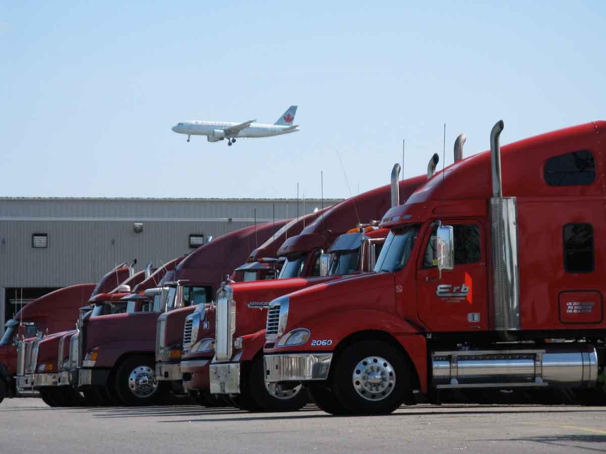
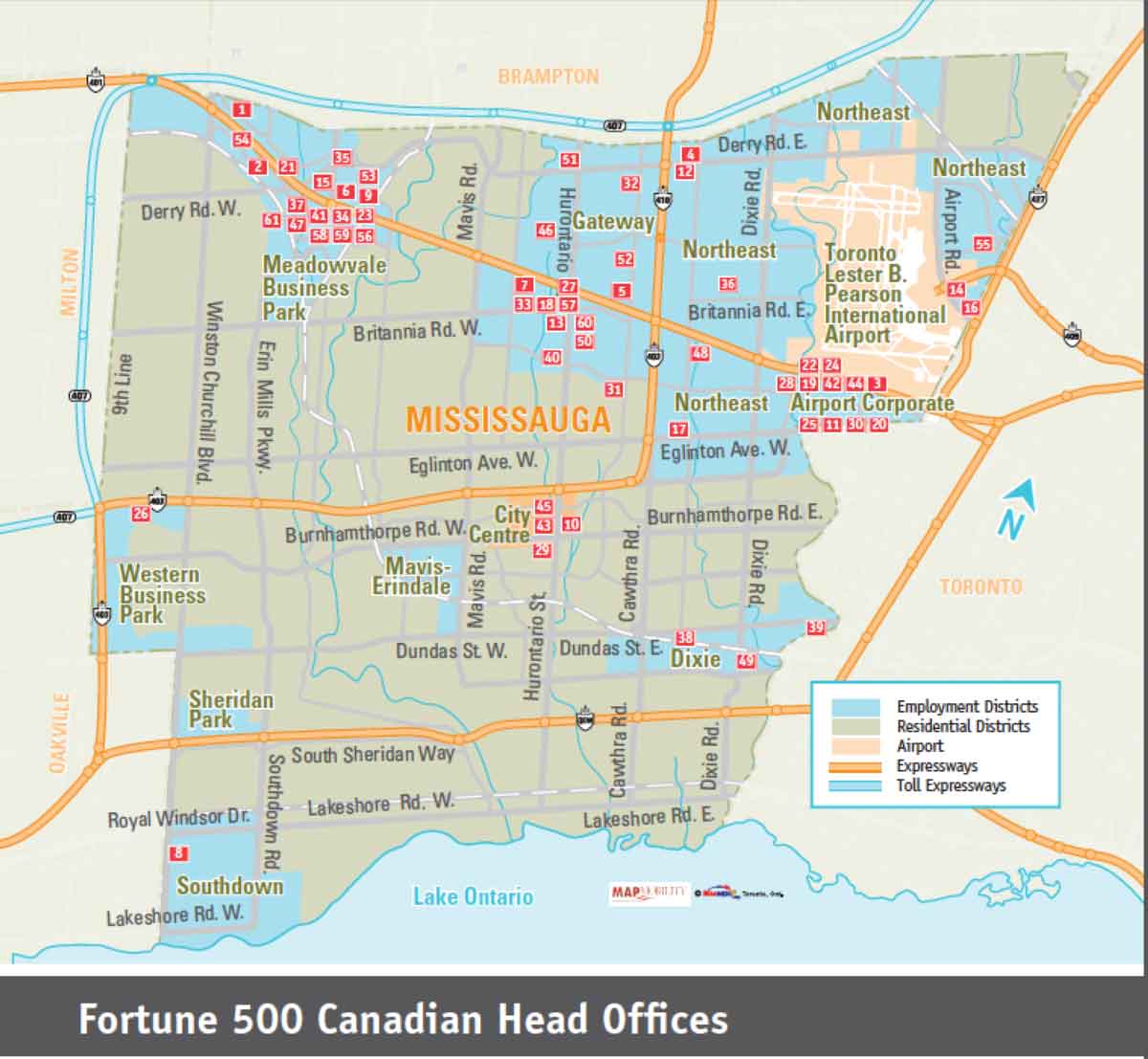
The area around the airport, also a major facility for importing goods, is one of the largest employment districts in Canada. As the map implies, access to the airport is probably a major reason why so many Fortune 500 Canadian head offices are located in Mississauga. This map is from promotional material distributed by Mississauga’s economic development office.
Finally, I think it helps to have a sense of the remarkable scale of these industrial/employment areas. The gallery below compares them with central Toronto between Bathurst and the Don Valley. All are clipped from Google Earth and show views from 7 kilometres up.
-
- Central Toronto, Bathurst on left, Don Valley on right, Bloor at top.
-
- Brampton, Mississauga employment district west of Pearson Airport
-
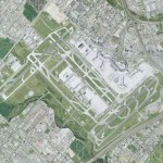
- Pearson Airport
-
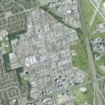
- Beaver Creek Employment District, Richmond Hill
-
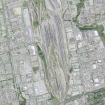
- Concord Rail Yard, Vaughan
-
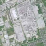
- GM Plant, Oshawa